
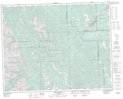
082J15 Bragg Creek Canada topo map, 1:50,000 scale
082J15 Bragg Creek NRCAN topographic map.
Includes UTM and GPS geographic coordinates (latitude and longitude). This 50k scale map is suitable for hiking, camping, and exploring, or you could frame it as a wall map.
Printed on-demand using high resolution, on heavy weight and acid free paper, or as an upgrade on a variety of synthetic materials.
Topos available on paper, Waterproof, Poly, or Tyvek. Usually shipping rolled, unless combined with other folded maps in one order.
- Product Number: NRCAN-082J15
- Parent Topo: TOPO-082J
- Map ID also known as: 082J15, 82J15
- Unfolded Size: Approximately 26" high by 36" wide
- Weight (paper map): ca. 55 grams
- Map Type: POD NRCAN Topographic Map
- Map Scale: 1:50,000
- Geographical region: Alberta, Canada
Neighboring Maps:
All neighboring Canadian topo maps are available for sale online at 1:50,000 scale.
Purchase the smaller scale map covering this area: Topo-082J
Spatial coverage:
Topo map sheet 082J15 Bragg Creek covers the following places:
- Elbow Falls - Réserve indienne Sarcee 145 - Sarcee Indian Reserve 145 - Tsuu T'ina Nation 145 - Allen Bill Pond - Champion Lakes - Forgetmenot Pond - McLean Pond - Allsmoke Mountain - Compression Ridge - Cox Hill - Fish Butte - Fisher Range - Forgetmenot Mountain - Forgetmenot Ridge - Jumpingpound Mountain - Last Break - Logan Ridge - McLean Hill - Mesa Butte - Montagnes Rocheuses - Moose Mountain - Mount Barwell - Mount Bryant - Mount Fullerton - Mount Glasgow - Mount Howard - Mount Quirk - Mount Remus - Mount Romulus - Nihahi Range - Nihahi Ridge - Pinetop Hill - Powder Face Ridge - Prairie Mountain - Robinson Hill - Rocky Mountain Foothills - Rocky Mountains - Square Butte - Two Pines - Municipal District of Foothills No. 31 - Municipal District of Rocky View No. 44 - Rocky View County - Improvement District No. 5 - Kananaskis Improvement District - Bragg Creek Provincial Park - Paddy's Flat - Bragg Creek - Canyon Creek - Connop Creek - Coxhill Creek - Elbow River - Fish Creek - Fisher Creek - Ford Creek - Glasgow Creek - Howard Creek - Iron Creek - Jumpingpound Creek - Little Elbow River - Lusk Creek - Mac Creek - McLean Creek - Mesa Creek - Moose Creek - Moose Dome Creek - Moose Mountain Creek - Muskeg Creek - Nihahi Creek - Powderface Creek - Prairie Creek - Priddis Creek - Quirk Creek - Rainy Creek - Ranger Creek - Shoulder Creek - Silvester Creek - South Glasgow Creek - Threepoint Creek - Trail Creek - Whiskey Creek - Bragg Creek - Redwood Meadows


