
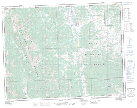
082J01 Langford Creek Canada topo map, 1:50,000 scale
082J01 Langford Creek NRCAN topographic map.
Includes UTM and GPS geographic coordinates (latitude and longitude). This 50k scale map is suitable for hiking, camping, and exploring, or you could frame it as a wall map.
Printed on-demand using high resolution, on heavy weight and acid free paper, or as an upgrade on a variety of synthetic materials.
Topos available on paper, Waterproof, Poly, or Tyvek. Usually shipping rolled, unless combined with other folded maps in one order.
- Product Number: NRCAN-082J01
- Parent Topo: TOPO-082J
- Map ID also known as: 082J01, 82J1, 82J01
- Unfolded Size: Approximately 26" high by 36" wide
- Weight (paper map): ca. 55 grams
- Map Type: POD NRCAN Topographic Map
- Map Scale: 1:50,000
- Geographical region: Alberta, Canada
Neighboring Maps:
All neighboring Canadian topo maps are available for sale online at 1:50,000 scale.
Purchase the smaller scale map covering this area: Topo-082J
Spatial coverage:
Topo map sheet 082J01 Langford Creek covers the following places:
- Livingstone Falls - Bear Pond - Chain Lakes - Chain Lakes Reservoir - Iron Lakes - Cabin Ridge - Chaffen Ridge - Hailstone Butte - Horseshoe Ridge - Isola Peak - Livingstone Range - Mount Livingstone - Porcupine Hills - Rocky Mountain Foothills - Trout Creek Ridge - Whaleback Ridge - Windy Peak - Municipal District of Ranchland No. 66 - Municipal District of Willow Creek No. 26 - Improvement District No. 5 - Improvement District of Ranchland No. 6 - Kananaskis Improvement District - Chain Lakes Provincial Park - Beagle Creek - Beaver Creek - Big Jim Creek - Bob Creek - Callum Creek - Chaffen Creek - Corral Creek - Deep Creek - Dry Creek - Hawkeye Creek - Hunter Creek - Iron Creek - Johnson Creek - Johnson Creek - King Bolt Creek - Langford Creek - Lanthier Creek - Lassie Creek - Livingstone River - Lyndon Creek - McIntosh Creek - Mean Creek - Mott Creek - Nelson Creek - Nelson Creek - North Lyndon Creek - North Twin Creek - O'Donnel Creek - Owl Creek - Pekisko Creek - Poole Creek - Raspberry Creek - Rice Creek - Rickman Creek - Ridge Creek - Riley Creek - Savanna Creek - ShaleCreek - South Twin Creek - South Willow Creek - South Willow Creek - Spears Creek - Speers Creek - Spring Creek - Swanson Creek - Timber Creek - Trout Creek - Ward Creek - Westrup Creek - White Creek - Willow Creek - Breeding Valley - Chandler Coulée - Dry Coulée - Happy Valley - Honey Coulée - Minor Coulée - Ropeo Gap - Sentinel Pass - Squaw Coulée - Timber Coulée - Trail Coulée - Wager Coulée


