~ Sunshine Reservoir WY topo map, 1:62500 scale, 15 X 15 Minute, Historical, 1957, updated 1984
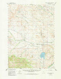
Sunshine Reservoir, Wyoming, USGS topographic map dated 1957.
Includes geographic coordinates (latitude and longitude). This topographic map is suitable for hiking, camping, and exploring, or framing it as a wall map.
Printed on-demand using high resolution imagery, on heavy weight and acid free paper, or alternatively on a variety of synthetic materials.
Topos available on paper, Waterproof, Poly, or Tyvek. Usually shipping rolled, unless combined with other folded maps in one order.
- Product Number: USGS-5617494
- Free digital map download (high-resolution, GeoPDF): Sunshine Reservoir, Wyoming (file size: 7 MB)
- Map Size: please refer to the dimensions of the GeoPDF map above
- Weight (paper map): ca. 55 grams
- Map Type: POD USGS Topographic Map
- Map Series: HTMC
- Map Verison: Historical
- Cell ID: 63120
- Scan ID: 342265
- Imprint Year: 1984
- Woodland Tint: Yes
- Aerial Photo Year: 1953
- Field Check Year: 1957
- Datum: NAD27
- Map Projection: Polyconic
- Map published by United States Geological Survey
- Map Language: English
- Scanner Resolution: 600 dpi
- Map Cell Name: Sunshine Reservoir
- Grid size: 15 X 15 Minute
- Date on map: 1957
- Map Scale: 1:62500
- Geographical region: Wyoming, United States
Neighboring Maps:
All neighboring USGS topo maps are available for sale online at a variety of scales.
Spatial coverage:
Topo map Sunshine Reservoir, Wyoming, covers the geographical area associated the following places:
- East Timber Creek - Sunshine Supply Ditch - Rose Creek - Pappapau Creek - Short Fork Meeteetse Creek - Timber Creek - Long Hollow Ditch - Z Bar T Ranch - West Fork Timber Creek - Francs Fork - Paradise Creek - Phelps Enlargement Thomas Dam - Tonopah Ridge - Pappapau Butte - Winninger Ranch - Sheep Creek - Little Rawhide Creek - Timber Creek Ranger Station - Pitchfork Ditch - Meeteetse Rim - Sheep Point - Pitchfork Ditch - Enlargement Upper Sunshine Reservoir - Schaub Butte - Four Bear Creek - Thomas Ranch - Joe Moss Ditch - Enlargement Upper Sunshine Dam - Little Rose Creek - Four Bear Oil Field - Phelps Enlargement Thomas Reservoir - Horse Creek Number 1 Dam - Spring Creek Oil Field - West Timber Creek - Orrs Mine - Pitchfork Oil Field - Sunshine Basin Ditch - Rush Creek - Pitchfork Ranch Cemetery - Middle Creek - Rush Creek Reservoir - Kay Creek - Rush Creek Dam - Pickett Creek - Pitchfork Oil Field - Butte Ditch - Horse Creek Number 1 Reservoir - Horse Creek - Pitchfork Ranch - Palette Ranch - Thomas Reservoir - Sunshine Reservoir - Meeteetse Division - Upper Sunshine Basin
- Map Area ID: AREA44.2544-109.25-109
- Northwest corner Lat/Long code: USGSNW44.25-109.25
- Northeast corner Lat/Long code: USGSNE44.25-109
- Southwest corner Lat/Long code: USGSSW44-109.25
- Southeast corner Lat/Long code: USGSSE44-109
- Northern map edge Latitude: 44.25
- Southern map edge Latitude: 44
- Western map edge Longitude: -109.25
- Eastern map edge Longitude: -109