
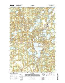
~ Birch Island Lake WI topo map, 1:24000 scale, 7.5 X 7.5 Minute, 2015
Birch Island Lake, Wisconsin, USGS topographic map dated 2015.
Includes geographic coordinates (latitude and longitude). This topographic map is suitable for hiking, camping, and exploring, or framing it as a wall map.
Printed on-demand using high resolution imagery, on heavy weight and acid free paper, or alternatively on a variety of synthetic materials.
Topos available on paper, Waterproof, Poly, or Tyvek. Usually shipping rolled, unless combined with other folded maps in one order.
- Product Number: USGS-7662234
- Free digital map download (high-resolution, GeoPDF): Birch Island Lake, Wisconsin (file size: 25 MB)
- Map Size: please refer to the dimensions of the GeoPDF map above
- Weight (paper map): ca. 55 grams
- Map Type: POD USGS Topographic Map
- Map Series: US Topo
- Map Verison: Current
- Cell ID: 3962
- Datum: North American Datum of 1983
- Map Projection: Transverse Mercator
- Map Cell Name: Birch Island Lake
- Grid size: 7.5 X 7.5 Minute
- Date on map: 2015
- Map Scale: 1:24000
- Geographical region: Wisconsin, United States
Neighboring Maps:
All neighboring USGS topo maps are available for sale online at a variety of scales.
Spatial coverage:
Topo map Birch Island Lake, Wisconsin, covers the geographical area associated the following places:
- Lost Lake - Upper Twin Lake - Round Lake - Lang Lake - Mud Lake - Sanks Lake - Myre Lake - Culbertson Lake - Culbertson Springs State Fishery Area - Little Mallard Lake - Long Lake - Jackson Townhall - Little Bear Lake - Voyager Village Airstrip - Pratt Lake - Jackson Cemetery - Mollete Lake - Shoal Lake - Coruick Lake - Loon Lake - Swamp Lake - Baker Lake - Lower Twin Lake - North Lang Lake - Pine Lake - Bass Lake - Green Lake - Loon Lake 2WP344 Dam - Leaf Lake - Boner Lake - Eagle Lake - Oak Lake - Radke Sand and Gravel Pit - Birch Island Lake - Bogey Lake - Sand Lake - Point Lake - Kilkare Marsh - Voyager Village Country Club - Jackson Township Fire Department - Moro School - Des Moines Lake - Cadotte Lake - Town of Jackson - Hanscom Lake - Phernetton Lake - Mallard Lake - Bartash Lake
- Map Area ID: AREA4645.875-92.25-92.125
- Northwest corner Lat/Long code: USGSNW46-92.25
- Northeast corner Lat/Long code: USGSNE46-92.125
- Southwest corner Lat/Long code: USGSSW45.875-92.25
- Southeast corner Lat/Long code: USGSSE45.875-92.125
- Northern map edge Latitude: 46
- Southern map edge Latitude: 45.875
- Western map edge Longitude: -92.25
- Eastern map edge Longitude: -92.125


