
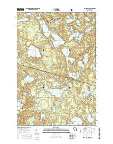
~ Black Oak Lake WI topo map, 1:24000 scale, 7.5 X 7.5 Minute, 2015
Black Oak Lake, Wisconsin, USGS topographic map dated 2015.
Includes geographic coordinates (latitude and longitude). This topographic map is suitable for hiking, camping, and exploring, or framing it as a wall map.
Printed on-demand using high resolution imagery, on heavy weight and acid free paper, or alternatively on a variety of synthetic materials.
Topos available on paper, Waterproof, Poly, or Tyvek. Usually shipping rolled, unless combined with other folded maps in one order.
- Product Number: USGS-7661724
- Free digital map download (high-resolution, GeoPDF): Black Oak Lake, Wisconsin (file size: 26 MB)
- Map Size: please refer to the dimensions of the GeoPDF map above
- Weight (paper map): ca. 55 grams
- Map Type: POD USGS Topographic Map
- Map Series: US Topo
- Map Verison: Current
- Cell ID: 4162
- Datum: North American Datum of 1983
- Map Projection: Transverse Mercator
- Map Cell Name: Black Oak Lake
- Grid size: 7.5 X 7.5 Minute
- Date on map: 2015
- Map Scale: 1:24000
- Geographical region: Wisconsin, United States
Neighboring Maps:
All neighboring USGS topo maps are available for sale online at a variety of scales.
Spatial coverage:
Topo map Black Oak Lake, Wisconsin, covers the geographical area associated the following places:
- Silvania Entrance Station - Ash Campground - Big Portage Lake - East Bear Lake - Mallard Campground - Boygan Lake - Whitefish Lake - Moss Lake - Conserve School - Glimmerglass Lake - Cub Lake - Osprey Campground - High Lake - Fisher Lake - Osceola Lake - Siskin Lake - Chipmunk Campground - Mink Campground - Coyote Campground - Elsie Lake - Badger Campground - Banks Lake - Dollar Lake - Pine Campground - Hay Lake - Liluis Lake - Fawn Lake - Balsam Campground - Porcupine Campground - Germain Lake - Loon Lake - Ermine Campground - Crooked Lake - Merrill Lake - Mill Lake - Little Portage Lake - Landing Lake - Pike Campground - Little Donahue Lake - Squirrel Campground - Helen Lake - Pickerel Creek - Duck Lake - Katherine Lake - Black Oak Lake - Canty Park Recreation Site - Dorothy Lake - Trapper Lake - Leon Campground - Oak Hill Cemetery - Ethel Lake - Little Bateau Lake - Anderson Lake - Sylvania Wilderness - Inkpot Lake - Clark Lake Picnic Area - Snap Jack Lake - Bear Campground - Pats Lake - Clear Lake - Fox Campground - Big Bateau Lake - Lynx Campground - Cedar Campground - Spring Lake - Clark Lake - Johnston Springs - WRJO-FM (Eagle River) - Birch Campground - Duck Lake - Mill Creek - Lake Elaine - Deer Island Lake - Emil Lake - Daisy Lake - Moccasin Lake - Fisher Campground - Florence Lake - Raccoon Campground - Perch Campground - Mountain Lake - Maple Campground - West Bear Lake - Land O' Lakes Cemetery - Wolf Campground - Beaver Campground - Long Lake - George Lake - Wood Lake - Kenu Lake - Eagle Campground - Kenu Lake 2WP941 Dam - Bobcat Campground - Lake O' Pines - Big Donahue Lake - Louise Lake - Lois Lake - Jay Lake - Corey Lake - Kerr Lake
- Map Area ID: AREA46.2546.125-89.375-89.25
- Northwest corner Lat/Long code: USGSNW46.25-89.375
- Northeast corner Lat/Long code: USGSNE46.25-89.25
- Southwest corner Lat/Long code: USGSSW46.125-89.375
- Southeast corner Lat/Long code: USGSSE46.125-89.25
- Northern map edge Latitude: 46.25
- Southern map edge Latitude: 46.125
- Western map edge Longitude: -89.375
- Eastern map edge Longitude: -89.25


