
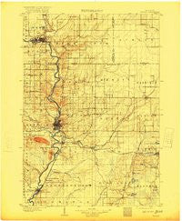
~ Wausau WI topo map, 1:125000 scale, 30 X 30 Minute, Historical, 1902, updated 1920
Wausau, Wisconsin, USGS topographic map dated 1902.
Includes geographic coordinates (latitude and longitude). This topographic map is suitable for hiking, camping, and exploring, or framing it as a wall map.
Printed on-demand using high resolution imagery, on heavy weight and acid free paper, or alternatively on a variety of synthetic materials.
Topos available on paper, Waterproof, Poly, or Tyvek. Usually shipping rolled, unless combined with other folded maps in one order.
- Product Number: USGS-6007771
- Free digital map download (high-resolution, GeoPDF): Wausau, Wisconsin (file size: 5 MB)
- Map Size: please refer to the dimensions of the GeoPDF map above
- Weight (paper map): ca. 55 grams
- Map Type: POD USGS Topographic Map
- Map Series: HTMC
- Map Verison: Historical
- Cell ID: 66901
- Scan ID: 803080
- Imprint Year: 1920
- Survey Year: 1899
- Datum: Unstated
- Map Projection: Unstated
- Map published by United States Geological Survey
- Map Language: English
- Scanner Resolution: 508 dpi
- Map Cell Name: Wausau
- Grid size: 30 X 30 Minute
- Date on map: 1902
- Map Scale: 1:125000
- Geographical region: Wisconsin, United States
Neighboring Maps:
All neighboring USGS topo maps are available for sale online at a variety of scales.
Spatial coverage:
Topo map Wausau, Wisconsin, covers the geographical area associated the following places:
- Maine - Brokaw - Wausau Junction - Hatley - Mount View - Merrill - Weston - Kalinke - Pike Lake - East Hill - Dutch Corners - Evergreen - Nutterville - Glandon - Rothschild - Bevent - Kelly - Mosinee - Doering - Ingersoll - Hogarty - Wausau - Granite Heights - Taegesville - Rib Mountain - Pine River - Johnson - Franklin Hill - Little Eau Claire - Kronenwetter - Peplin - Sunset - Schofield - Callon - Norrie - Ringle - Snell
- Map Area ID: AREA45.2544.75-89.75-89.25
- Northwest corner Lat/Long code: USGSNW45.25-89.75
- Northeast corner Lat/Long code: USGSNE45.25-89.25
- Southwest corner Lat/Long code: USGSSW44.75-89.75
- Southeast corner Lat/Long code: USGSSE44.75-89.25
- Northern map edge Latitude: 45.25
- Southern map edge Latitude: 44.75
- Western map edge Longitude: -89.75
- Eastern map edge Longitude: -89.25


