
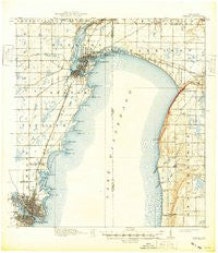
~ Neenah WI topo map, 1:62500 scale, 15 X 15 Minute, Historical, 1911, updated 1949
Neenah, Wisconsin, USGS topographic map dated 1911.
Includes geographic coordinates (latitude and longitude). This topographic map is suitable for hiking, camping, and exploring, or framing it as a wall map.
Printed on-demand using high resolution imagery, on heavy weight and acid free paper, or alternatively on a variety of synthetic materials.
Topos available on paper, Waterproof, Poly, or Tyvek. Usually shipping rolled, unless combined with other folded maps in one order.
- Product Number: USGS-6007158
- Free digital map download (high-resolution, GeoPDF): Neenah, Wisconsin (file size: 5 MB)
- Map Size: please refer to the dimensions of the GeoPDF map above
- Weight (paper map): ca. 55 grams
- Map Type: POD USGS Topographic Map
- Map Series: HTMC
- Map Verison: Historical
- Cell ID: 58308
- Scan ID: 802926
- Imprint Year: 1949
- Survey Year: 1908
- Datum: Unstated
- Map Projection: Polyconic
- Map published by United States Geological Survey
- Keywords: Overedge
- Map Language: English
- Scanner Resolution: 508 dpi
- Map Cell Name: Neenah
- Grid size: 15 X 15 Minute
- Date on map: 1911
- Map Scale: 1:62500
- Geographical region: Wisconsin, United States
Neighboring Maps:
All neighboring USGS topo maps are available for sale online at a variety of scales.
Spatial coverage:
Topo map Neenah, Wisconsin, covers the geographical area associated the following places:
- Neenah - Harrison (historical) - Fox Crossing - Dorns Faro Springs Beach - Adella Beach - Dorns Twilight Beach - Sunset Beach - Stockbridge - Rockaway Beach - Menasha - Sherwood - Eckers Lakeland - Darboy - Ricker Bay - Harrison - Quinney - High Cliff (historical) - Saint Catherines Bay - Utowana Beach - Kloten - Sunrise Bay - Brighton Beach - Waverly Beach - Snells - Rainbow Beach - Highland Beach
- Map Area ID: AREA44.2544-88.5-88.25
- Northwest corner Lat/Long code: USGSNW44.25-88.5
- Northeast corner Lat/Long code: USGSNE44.25-88.25
- Southwest corner Lat/Long code: USGSSW44-88.5
- Southeast corner Lat/Long code: USGSSE44-88.25
- Northern map edge Latitude: 44.25
- Southern map edge Latitude: 44
- Western map edge Longitude: -88.5
- Eastern map edge Longitude: -88.25


