
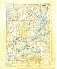
~ Eagle WI topo map, 1:62500 scale, 15 X 15 Minute, Historical, 1906, updated 1934
Eagle, Wisconsin, USGS topographic map dated 1906.
Includes geographic coordinates (latitude and longitude). This topographic map is suitable for hiking, camping, and exploring, or framing it as a wall map.
Printed on-demand using high resolution imagery, on heavy weight and acid free paper, or alternatively on a variety of synthetic materials.
Topos available on paper, Waterproof, Poly, or Tyvek. Usually shipping rolled, unless combined with other folded maps in one order.
- Product Number: USGS-6007056
- Free digital map download (high-resolution, GeoPDF): Eagle, Wisconsin (file size: 5 MB)
- Map Size: please refer to the dimensions of the GeoPDF map above
- Weight (paper map): ca. 55 grams
- Map Type: POD USGS Topographic Map
- Map Series: HTMC
- Map Verison: Historical
- Cell ID: 53638
- Scan ID: 801529
- Imprint Year: 1934
- Edit Year: 1903
- Survey Year: 1889
- Datum: NAD
- Map Projection: Polyconic
- Map published by United States Geological Survey
- Map Language: English
- Scanner Resolution: 508 dpi
- Map Cell Name: Eagle
- Grid size: 15 X 15 Minute
- Date on map: 1906
- Map Scale: 1:62500
- Geographical region: Wisconsin, United States
Neighboring Maps:
All neighboring USGS topo maps are available for sale online at a variety of scales.
Spatial coverage:
Topo map Eagle, Wisconsin, covers the geographical area associated the following places:
- Potter Lake - Genesee Depot - Mukwonago - Skyview Terrace - Hilburn - Eagle - Bethesda - Oak Knoll - Mayhews (historical) - Troy Center - Vernon - North Prairie - Troy - East Troy - Ottawa - Genesee - Jericho - Eagleville - Lake Beulah - Army Lake (historical) - Saylesville - Caldwell
- Map Area ID: AREA4342.75-88.5-88.25
- Northwest corner Lat/Long code: USGSNW43-88.5
- Northeast corner Lat/Long code: USGSNE43-88.25
- Southwest corner Lat/Long code: USGSSW42.75-88.5
- Southeast corner Lat/Long code: USGSSE42.75-88.25
- Northern map edge Latitude: 43
- Southern map edge Latitude: 42.75
- Western map edge Longitude: -88.5
- Eastern map edge Longitude: -88.25


