
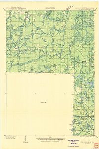
~ Thunder Mtn WI topo map, 1:48000 scale, 15 X 15 Minute, Historical, 1940
Thunder Mtn , Wisconsin, USGS topographic map dated 1940.
Includes geographic coordinates (latitude and longitude). This topographic map is suitable for hiking, camping, and exploring, or framing it as a wall map.
Printed on-demand using high resolution imagery, on heavy weight and acid free paper, or alternatively on a variety of synthetic materials.
Topos available on paper, Waterproof, Poly, or Tyvek. Usually shipping rolled, unless combined with other folded maps in one order.
- Product Number: USGS-6000754
- Free digital map download (high-resolution, GeoPDF): Thunder Mtn , Wisconsin (file size: 5 MB)
- Map Size: please refer to the dimensions of the GeoPDF map above
- Weight (paper map): ca. 55 grams
- Map Type: POD USGS Topographic Map
- Map Series: HTMC
- Map Verison: Historical
- Cell ID: 63551
- Scan ID: 503570
- Woodland Tint: Yes
- Field Check Year: 1940
- Datum: NAD27
- Map Projection: Polyconic
- Advance: Yes
- Planimetric: Yes
- Map published by United States Geological Survey
- Map Language: English
- Scanner Resolution: 508 dpi
- Map Cell Name: Thunder Mountain
- Grid size: 15 X 15 Minute
- Date on map: 1940
- Map Scale: 1:48000
- Geographical region: Wisconsin, United States
Neighboring Maps:
All neighboring USGS topo maps are available for sale online at a variety of scales.
Spatial coverage:
Topo map Thunder Mtn , Wisconsin, covers the geographical area associated the following places:
- Dell Lake - Thunder Mountain - Hay Creek - Boundary Lake - North Fork Thunder River - Mary Park - Sullivan Springs - West Thunder Creek - Deer Lake Flowage - Munger Lake - John Lake - Harper Lake - Buck Lake - Sand Lake - Flower Lake - Wheeler Lake - Thunder Mountain Ranch - Ledge Lake - Miriam Lake - Huber Lake - Cloud Lake - Balsam Lake - Saint Mary of the Cliff Church - Wheeler Lake Swimming Beach - Hoyle and Johnson 3WR-1647 Dam - Rollins Lake - McCaslin Lookout Tower - Taylor Lake - Perch Lake - Battle Creek - Brandywine Creek - Evergreen Lake - Virgin Island - Campbell Creek - McCaslin Lake - Camp Bird State Youth Recreational Center - Homestead Lake - Snow Falls Creek State Natural Area - Newman Creek - Bullfrog Lake - Knowles Creek - Kiss Lake - Rat River - Thunder River State Rearing Station - Lakewood Country Club Airport (historical) - Wonder Lake - Forbes Spring - Spruce Lake - Town of Silver Cliff - Mc Clintock County Park - Lake Irwin - Rooney Lake - Mirror Lake - Forbes Creek - South Fork Thunder River - Babson Pond - Smith Creek - Silver Cliff Volunteer Fire Department - Swamp Creek - The Spring - Twin Bessies - Camp Five Creek - Bottle Lake - Fryingpan Lake - Snow Falls Creek - Waubee Lake - Pine Ridge Lake - McCaslin Brook - Birch Lake - Homestead Creek - Crandall Lake - Deer Lake - Borth Lake - Three Little Lakes - Lakewood Volunteer Fire Department - Deer Lake Outlet Flowage - Otter Creek - Hazel Lake - Handsaw Creek - Deer Island - Roaring Rapids - Frieda Lake - McCaslin Mountain State Natural Area - Wilson Rapids - Spring Creek - East Thunder Creek - Paya Lake - Crane Lake - Deer Lake D12.198 Dam - Lackawanna Lake - Hickey Springs - Spring Creek - Brandywine Lake - Marinette County Beech Forest State Natural Area - King Lake - Shady Nook School (historical) - Berry Lake - Mountain Lake - Caldron Falls Reservoir - Cedar Lake
- Map Area ID: AREA45.545.25-88.5-88.25
- Northwest corner Lat/Long code: USGSNW45.5-88.5
- Northeast corner Lat/Long code: USGSNE45.5-88.25
- Southwest corner Lat/Long code: USGSSW45.25-88.5
- Southeast corner Lat/Long code: USGSSE45.25-88.25
- Northern map edge Latitude: 45.5
- Southern map edge Latitude: 45.25
- Western map edge Longitude: -88.5
- Eastern map edge Longitude: -88.25


