
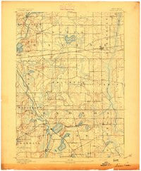
~ Silver Lake WI topo map, 1:62500 scale, 15 X 15 Minute, Historical, 1893
Silver Lake, Wisconsin, USGS topographic map dated 1893.
Includes geographic coordinates (latitude and longitude). This topographic map is suitable for hiking, camping, and exploring, or framing it as a wall map.
Printed on-demand using high resolution imagery, on heavy weight and acid free paper, or alternatively on a variety of synthetic materials.
Topos available on paper, Waterproof, Poly, or Tyvek. Usually shipping rolled, unless combined with other folded maps in one order.
- Product Number: USGS-6000434
- Free digital map download (high-resolution, GeoPDF): Silver Lake, Wisconsin (file size: 5 MB)
- Map Size: please refer to the dimensions of the GeoPDF map above
- Weight (paper map): ca. 55 grams
- Map Type: POD USGS Topographic Map
- Map Series: HTMC
- Map Verison: Historical
- Cell ID: 62559
- Scan ID: 801285
- Survey Year: 1891
- Datum: Unstated
- Map Projection: Unstated
- Map published by United States Geological Survey
- Map Language: English
- Scanner Resolution: 508 dpi
- Map Cell Name: Silver Lake
- Grid size: 15 X 15 Minute
- Date on map: 1893
- Map Scale: 1:62500
- Geographical region: Wisconsin, United States
Neighboring Maps:
All neighboring USGS topo maps are available for sale online at a variety of scales.
Spatial coverage:
Topo map Silver Lake, Wisconsin, covers the geographical area associated the following places:
- Browns Lake - Bristol - Silver Lake - Twin Lakes - Bassett - Wheatland - Fox River - Rosewood - Eagle Lake Terrace - Wilmot - Carefree Estates - Paddock Lake - Trevor - Garden Grove Mobile Home Park - Klondike - Eagle Lake - Lake Shangrila - Lorimar Estates - Eagle Lake Manor - Wheatland Estates - Liberty Corners - New Munster - Beaumont - Kansasville - Yorkville - Camp Lake - Salem - Brighton - Shady Nook Mobile Home Park - Paris - Salem Oaks - Hickory Haven - Woodworth - Rochester - Cedar Park - Union Grove - Browns Lake Mobile Home Park
- Map Area ID: AREA42.7542.5-88.25-88
- Northwest corner Lat/Long code: USGSNW42.75-88.25
- Northeast corner Lat/Long code: USGSNE42.75-88
- Southwest corner Lat/Long code: USGSSW42.5-88.25
- Southeast corner Lat/Long code: USGSSE42.5-88
- Northern map edge Latitude: 42.75
- Southern map edge Latitude: 42.5
- Western map edge Longitude: -88.25
- Eastern map edge Longitude: -88


