
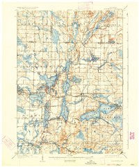
~ Oconomowoc WI topo map, 1:62500 scale, 15 X 15 Minute, Historical, 1909, updated 1934
Oconomowoc, Wisconsin, USGS topographic map dated 1909.
Includes geographic coordinates (latitude and longitude). This topographic map is suitable for hiking, camping, and exploring, or framing it as a wall map.
Printed on-demand using high resolution imagery, on heavy weight and acid free paper, or alternatively on a variety of synthetic materials.
Topos available on paper, Waterproof, Poly, or Tyvek. Usually shipping rolled, unless combined with other folded maps in one order.
- Product Number: USGS-5999652
- Free digital map download (high-resolution, GeoPDF): Oconomowoc, Wisconsin (file size: 6 MB)
- Map Size: please refer to the dimensions of the GeoPDF map above
- Weight (paper map): ca. 55 grams
- Map Type: POD USGS Topographic Map
- Map Series: HTMC
- Map Verison: Historical
- Cell ID: 55127
- Scan ID: 801251
- Imprint Year: 1934
- Survey Year: 1907
- Datum: NAD
- Map Projection: Polyconic
- Map published by United States Geological Survey
- Map Language: English
- Scanner Resolution: 508 dpi
- Map Cell Name: Hartland
- Grid size: 15 X 15 Minute
- Date on map: 1909
- Map Scale: 1:62500
- Geographical region: Wisconsin, United States
Neighboring Maps:
All neighboring USGS topo maps are available for sale online at a variety of scales.
Spatial coverage:
Topo map Oconomowoc, Wisconsin, covers the geographical area associated the following places:
- Pewaukee West - Summit Center - Oconomowoc Lake - Alderley - Hartland - Wales - Dousman - Okauchee Lake - Waterville - Plat - Merton - North Lake - Oconomowoc - Chenequa - Summit Corners - Nashotah - Buena Vista - Utica - Mapleton - Okauchee - Monterey - Stonebank - Monches - Lake Five - Pewaukee - Camp Whitcomb - Edgewood - Delafield
- Map Area ID: AREA43.2543-88.5-88.25
- Northwest corner Lat/Long code: USGSNW43.25-88.5
- Northeast corner Lat/Long code: USGSNE43.25-88.25
- Southwest corner Lat/Long code: USGSSW43-88.5
- Southeast corner Lat/Long code: USGSSE43-88.25
- Northern map edge Latitude: 43.25
- Southern map edge Latitude: 43
- Western map edge Longitude: -88.5
- Eastern map edge Longitude: -88.25


