
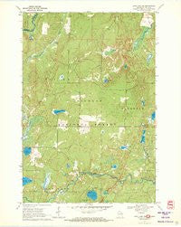
~ Long Lake NE WI topo map, 1:24000 scale, 7.5 X 7.5 Minute, Historical, 1970, updated 1972
Long Lake NE, Wisconsin, USGS topographic map dated 1970.
Includes geographic coordinates (latitude and longitude). This topographic map is suitable for hiking, camping, and exploring, or framing it as a wall map.
Printed on-demand using high resolution imagery, on heavy weight and acid free paper, or alternatively on a variety of synthetic materials.
Topos available on paper, Waterproof, Poly, or Tyvek. Usually shipping rolled, unless combined with other folded maps in one order.
- Product Number: USGS-5998898
- Free digital map download (high-resolution, GeoPDF): Long Lake NE, Wisconsin (file size: 8 MB)
- Map Size: please refer to the dimensions of the GeoPDF map above
- Weight (paper map): ca. 55 grams
- Map Type: POD USGS Topographic Map
- Map Series: HTMC
- Map Verison: Historical
- Cell ID: 26466
- Scan ID: 500802
- Imprint Year: 1972
- Woodland Tint: Yes
- Aerial Photo Year: 1966
- Field Check Year: 1970
- Datum: NAD27
- Map Projection: Polyconic
- Map published by United States Geological Survey
- Map Language: English
- Scanner Resolution: 508 dpi
- Map Cell Name: Long Lake NE
- Grid size: 7.5 X 7.5 Minute
- Date on map: 1970
- Map Scale: 1:24000
- Geographical region: Wisconsin, United States
Neighboring Maps:
All neighboring USGS topo maps are available for sale online at a variety of scales.
Spatial coverage:
Topo map Long Lake NE, Wisconsin, covers the geographical area associated the following places:
- Reisner Lake - Lost Lake - Little Porcupine Lake - Lauterman Lake - Lost Lake Campground - Florence County Park Campground - Trout Springs - Lake of Dreams - East Fork LeRoy Creek - Chipmunk Rapids Campground - French and Losey Siding (historical) - Birch Lake - Porcupine Lake - Purdue University Forestry Camp - Wisconsin Slough - Chipmunk Rapids - Wisconsin Slough State Natural Area - Mud Lake - Lauterman Trail - Perch Lake - Town of Tipler - Hemlock Lake - Silverdollar Lake - Lauterman Lake Walk-In Campground - Chipmunk Creek - Dahls Siding (historical) - Spruce Lake
- Map Area ID: AREA4645.875-88.625-88.5
- Northwest corner Lat/Long code: USGSNW46-88.625
- Northeast corner Lat/Long code: USGSNE46-88.5
- Southwest corner Lat/Long code: USGSSW45.875-88.625
- Southeast corner Lat/Long code: USGSSE45.875-88.5
- Northern map edge Latitude: 46
- Southern map edge Latitude: 45.875
- Western map edge Longitude: -88.625
- Eastern map edge Longitude: -88.5


