
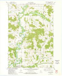
~ Colfax North WI topo map, 1:24000 scale, 7.5 X 7.5 Minute, Historical, 1975, updated 1978
Colfax North, Wisconsin, USGS topographic map dated 1975.
Includes geographic coordinates (latitude and longitude). This topographic map is suitable for hiking, camping, and exploring, or framing it as a wall map.
Printed on-demand using high resolution imagery, on heavy weight and acid free paper, or alternatively on a variety of synthetic materials.
Topos available on paper, Waterproof, Poly, or Tyvek. Usually shipping rolled, unless combined with other folded maps in one order.
- Product Number: USGS-5997562
- Free digital map download (high-resolution, GeoPDF): Colfax North, Wisconsin (file size: 7 MB)
- Map Size: please refer to the dimensions of the GeoPDF map above
- Weight (paper map): ca. 55 grams
- Map Type: POD USGS Topographic Map
- Map Series: HTMC
- Map Verison: Historical
- Cell ID: 9569
- Scan ID: 500288
- Imprint Year: 1978
- Woodland Tint: Yes
- Aerial Photo Year: 1974
- Field Check Year: 1975
- Datum: NAD27
- Map Projection: Lambert Conformal Conic
- Map published by United States Geological Survey
- Map Language: English
- Scanner Resolution: 508 dpi
- Map Cell Name: Colfax North
- Grid size: 7.5 X 7.5 Minute
- Date on map: 1975
- Map Scale: 1:24000
- Geographical region: Wisconsin, United States
Neighboring Maps:
All neighboring USGS topo maps are available for sale online at a variety of scales.
Spatial coverage:
Topo map Colfax North, Wisconsin, covers the geographical area associated the following places:
- Lower Running Valley Cemetery - Bronken Creek - Eddies Creek - Running Valley Creek - Town of Grant - Howard Townhall - Academic Center - Valley Glen School (historical) - Popple Creek - Eighteenmile Creek - Oak Hill School (historical) - Holden Church - Riverview School (historical) - Colfax Wastewater Treatment Facility - South Fork Trout Creek - Popple Creek Cemetery - County Line Farms - Running Valley School (historical) - Grant Townhall - North Running Valley Church - Trout Creek - Everson School (historical) - Mirror Lake - Faith Church - Twentytwo Mile Ford Park - Saint Johns Church - Evergreen Cemetery - Colfax High School - Trout Creek School (historical) - Colfax Elementary School - Popple Creek School (historical)
- Map Area ID: AREA45.12545-91.75-91.625
- Northwest corner Lat/Long code: USGSNW45.125-91.75
- Northeast corner Lat/Long code: USGSNE45.125-91.625
- Southwest corner Lat/Long code: USGSSW45-91.75
- Southeast corner Lat/Long code: USGSSE45-91.625
- Northern map edge Latitude: 45.125
- Southern map edge Latitude: 45
- Western map edge Longitude: -91.75
- Eastern map edge Longitude: -91.625


