
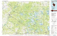
~ Black River Falls WI topo map, 1:100000 scale, 30 X 60 Minute, Historical, 1985, updated 1985
Black River Falls, Wisconsin, USGS topographic map dated 1985.
Includes geographic coordinates (latitude and longitude). This topographic map is suitable for hiking, camping, and exploring, or framing it as a wall map.
Printed on-demand using high resolution imagery, on heavy weight and acid free paper, or alternatively on a variety of synthetic materials.
Topos available on paper, Waterproof, Poly, or Tyvek. Usually shipping rolled, unless combined with other folded maps in one order.
- Product Number: USGS-5997306
- Free digital map download (high-resolution, GeoPDF): Black River Falls, Wisconsin (file size: 19 MB)
- Map Size: please refer to the dimensions of the GeoPDF map above
- Weight (paper map): ca. 55 grams
- Map Type: POD USGS Topographic Map
- Map Series: HTMC
- Map Verison: Historical
- Cell ID: 67146
- Scan ID: 503641
- Imprint Year: 1985
- Woodland Tint: Yes
- Aerial Photo Year: 1980
- Edit Year: 1985
- Datum: NAD27
- Map Projection: Universal Transverse Mercator
- Planimetric: Yes
- Map published by United States Geological Survey
- Map Language: English
- Scanner Resolution: 508 dpi
- Map Cell Name: Black River Falls
- Grid size: 30 X 60 Minute
- Date on map: 1985
- Map Scale: 1:100000
- Geographical region: Wisconsin, United States
Neighboring Maps:
All neighboring USGS topo maps are available for sale online at a variety of scales.
Spatial coverage:
Topo map Black River Falls, Wisconsin, covers the geographical area associated the following places:
- Cataract - Necedah - Shortville - Dexterville - Vaudreuil - New Miner - Hatfield - Finley - Shennington - Clay (historical) - Pittsville - Sprague - Mather - City Point - Four Corners - Black River Falls - Nevins - Kirby - Tunnel City - Shamrock - Spring Bank Park - North Branch - Millston - Irving - Sherwood - Trow (historical) - Alma Center - Wyeville - Cutler - North Tomah - Wrightsville (historical) - Waterbury - Valley Junction - Veedum - Melrose - Winnebago Mission - Merrillan - Norway Ridge - Brockway - Babcock - Sheppard - Meadow Valley - Cranmoor - Spaulding - Speck Oaks - Fall Hall Glen - Charter Oak Mills (historical) - Warrens - Cloverdale - Pray - Lapham Junction
- Map Area ID: AREA44.544-91-90
- Northwest corner Lat/Long code: USGSNW44.5-91
- Northeast corner Lat/Long code: USGSNE44.5-90
- Southwest corner Lat/Long code: USGSSW44-91
- Southeast corner Lat/Long code: USGSSE44-90
- Northern map edge Latitude: 44.5
- Southern map edge Latitude: 44
- Western map edge Longitude: -91
- Eastern map edge Longitude: -90


