
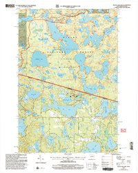
~ Black Oak Lake WI topo map, 1:24000 scale, 7.5 X 7.5 Minute, Historical, 1999, updated 2005
Black Oak Lake, Wisconsin, USGS topographic map dated 1999.
Includes geographic coordinates (latitude and longitude). This topographic map is suitable for hiking, camping, and exploring, or framing it as a wall map.
Printed on-demand using high resolution imagery, on heavy weight and acid free paper, or alternatively on a variety of synthetic materials.
Topos available on paper, Waterproof, Poly, or Tyvek. Usually shipping rolled, unless combined with other folded maps in one order.
- Product Number: USGS-5997304
- Free digital map download (high-resolution, GeoPDF): Black Oak Lake, Wisconsin (file size: 11 MB)
- Map Size: please refer to the dimensions of the GeoPDF map above
- Weight (paper map): ca. 55 grams
- Map Type: POD USGS Topographic Map
- Map Series: HTMC
- Map Verison: Historical
- Cell ID: 4162
- Scan ID: 800052
- Imprint Year: 2005
- Woodland Tint: Yes
- Aerial Photo Year: 1999
- Edit Year: 1999
- Datum: NAD27
- Map Projection: Lambert Conformal Conic
- Map published by United States Forest Service
- Map Language: English
- Scanner Resolution: 508 dpi
- Map Cell Name: Black Oak Lake
- Grid size: 7.5 X 7.5 Minute
- Date on map: 1999
- Map Scale: 1:24000
- Geographical region: Wisconsin, United States
Neighboring Maps:
All neighboring USGS topo maps are available for sale online at a variety of scales.
Spatial coverage:
Topo map Black Oak Lake, Wisconsin, covers the geographical area associated the following places:
- Big Donahue Lake - Black Oak Lake - Lynx Campground - Little Bateau Lake - Land O' Lakes Cemetery - Helen Lake - Badger Campground - Clear Lake - High Lake - Hay Lake - Trapper Lake - Corey Lake - Liluis Lake - Mill Creek - Osprey Campground - Bear Campground - Clark Lake Picnic Area - West Bear Lake - Wood Lake - Balsam Campground - Loon Lake - Canty Park Recreation Site - Florence Lake - Birch Campground - Jay Lake - Chipmunk Campground - Pine Campground - Duck Lake - Little Donahue Lake - Deer Island Lake - Silvania Entrance Station - Daisy Lake - Raccoon Campground - Emil Lake - Fawn Lake - Mink Campground - Moss Lake - Crooked Lake - Eagle Campground - Moccasin Lake - East Bear Lake - Cub Lake - Pike Campground - Leon Campground - Conserve School - Boygan Lake - Wolf Campground - Perch Campground - Louise Lake - Kenu Lake 2WP941 Dam - Bass Campground - Big Bateau Lake - Dorothy Lake - Lake O' Pines - Glimmerglass Lake - Fox Campground - George Lake - Spring Lake - Ash Campground - Snap Jack Lake - Mountain Lake - Merrill Lake - Porcupine Campground - Duck Lake - Osceola Lake - Lake Elaine - Beaver Campground - Kerr Lake - Bobcat Campground - Fisher Campground - Ethel Lake - Big Portage Lake - Sylvania Wilderness - Banks Lake - Fisher Lake - Dollar Lake - WRJO-FM (Eagle River) - Oak Hill Cemetery - Siskin Lake - Lois Lake - Ermine Campground - Katherine Lake - Johnston Springs - Whitefish Lake - Mallard Campground - Little Portage Lake - Landing Lake - Clark Lake - Germain Lake - Anderson Lake - Elsie Lake - Kenu Lake - Pickerel Creek - Maple Campground - Cedar Campground - Long Lake - Pats Lake - Inkpot Lake - Coyote Campground - Mill Lake
- Map Area ID: AREA46.2546.125-89.375-89.25
- Northwest corner Lat/Long code: USGSNW46.25-89.375
- Northeast corner Lat/Long code: USGSNE46.25-89.25
- Southwest corner Lat/Long code: USGSSW46.125-89.375
- Southeast corner Lat/Long code: USGSSE46.125-89.25
- Northern map edge Latitude: 46.25
- Southern map edge Latitude: 46.125
- Western map edge Longitude: -89.375
- Eastern map edge Longitude: -89.25


