
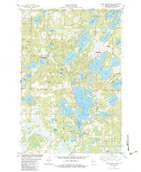
~ Birch Island Lake WI topo map, 1:24000 scale, 7.5 X 7.5 Minute, Historical, 1982, updated 1983
Birch Island Lake, Wisconsin, USGS topographic map dated 1982.
Includes geographic coordinates (latitude and longitude). This topographic map is suitable for hiking, camping, and exploring, or framing it as a wall map.
Printed on-demand using high resolution imagery, on heavy weight and acid free paper, or alternatively on a variety of synthetic materials.
Topos available on paper, Waterproof, Poly, or Tyvek. Usually shipping rolled, unless combined with other folded maps in one order.
- Product Number: USGS-5997288
- Free digital map download (high-resolution, GeoPDF): Birch Island Lake, Wisconsin (file size: 11 MB)
- Map Size: please refer to the dimensions of the GeoPDF map above
- Weight (paper map): ca. 55 grams
- Map Type: POD USGS Topographic Map
- Map Series: HTMC
- Map Verison: Historical
- Cell ID: 3962
- Scan ID: 800286
- Imprint Year: 1983
- Woodland Tint: Yes
- Aerial Photo Year: 1979
- Edit Year: 1982
- Field Check Year: 1979
- Datum: NAD27
- Map Projection: Lambert Conformal Conic
- Map published by United States Geological Survey
- Map Language: English
- Scanner Resolution: 508 dpi
- Map Cell Name: Birch Island Lake
- Grid size: 7.5 X 7.5 Minute
- Date on map: 1982
- Map Scale: 1:24000
- Geographical region: Wisconsin, United States
Neighboring Maps:
All neighboring USGS topo maps are available for sale online at a variety of scales.
Spatial coverage:
Topo map Birch Island Lake, Wisconsin, covers the geographical area associated the following places:
- Radke Sand and Gravel Pit - Little Mallard Lake - Shoal Lake - North Lang Lake - Lost Lake - Jackson Cemetery - Oak Lake - Jackson Township Fire Department - Swamp Lake - Des Moines Lake - Point Lake - Loon Lake 2WP344 Dam - Moro School - Round Lake - Mud Lake - Bartash Lake - Eagle Lake - Mollete Lake - Sand Lake - Phernetton Lake - Boner Lake - Kilkare Marsh - Lower Twin Lake - Bogey Lake - Long Lake - Culbertson Lake - Jackson Townhall - Baker Lake - Loon Lake - Cadotte Lake - Culbertson Springs State Fishery Area - Voyager Village Country Club - Voyager Village Airstrip - Pine Lake - Sanks Lake - Bass Lake - Birch Island Lake - Mallard Lake - Myre Lake - Upper Twin Lake - Town of Jackson - Hanscom Lake - Little Bear Lake - Coruick Lake - Lang Lake - Green Lake - Pratt Lake - Leaf Lake
- Map Area ID: AREA4645.875-92.25-92.125
- Northwest corner Lat/Long code: USGSNW46-92.25
- Northeast corner Lat/Long code: USGSNE46-92.125
- Southwest corner Lat/Long code: USGSSW45.875-92.25
- Southeast corner Lat/Long code: USGSSE45.875-92.125
- Northern map edge Latitude: 46
- Southern map edge Latitude: 45.875
- Western map edge Longitude: -92.25
- Eastern map edge Longitude: -92.125


