
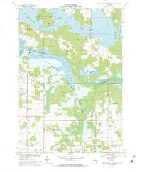
~ Big Eau Pleine Reservoir WI topo map, 1:24000 scale, 7.5 X 7.5 Minute, Historical, 1970, updated 1984
Big Eau Pleine Reservoir, Wisconsin, USGS topographic map dated 1970.
Includes geographic coordinates (latitude and longitude). This topographic map is suitable for hiking, camping, and exploring, or framing it as a wall map.
Printed on-demand using high resolution imagery, on heavy weight and acid free paper, or alternatively on a variety of synthetic materials.
Topos available on paper, Waterproof, Poly, or Tyvek. Usually shipping rolled, unless combined with other folded maps in one order.
- Product Number: USGS-5997278
- Free digital map download (high-resolution, GeoPDF): Big Eau Pleine Reservoir, Wisconsin (file size: 9 MB)
- Map Size: please refer to the dimensions of the GeoPDF map above
- Weight (paper map): ca. 55 grams
- Map Type: POD USGS Topographic Map
- Map Series: HTMC
- Map Verison: Historical
- Cell ID: 3698
- Scan ID: 800281
- Imprint Year: 1984
- Woodland Tint: Yes
- Aerial Photo Year: 1968
- Field Check Year: 1970
- Datum: NAD27
- Map Projection: Polyconic
- Map published by United States Geological Survey
- Map Language: English
- Scanner Resolution: 508 dpi
- Map Cell Name: Big Eau Pleine Reservoir
- Grid size: 7.5 X 7.5 Minute
- Date on map: 1970
- Map Scale: 1:24000
- Geographical region: Wisconsin, United States
Neighboring Maps:
All neighboring USGS topo maps are available for sale online at a variety of scales.
Spatial coverage:
Topo map Big Eau Pleine Reservoir, Wisconsin, covers the geographical area associated the following places:
- Runkle Cemetery - Clark Ginseng Farm - Kudla Farms - Rucinski Farms - Big Eau Pleine Woods State Natural Area - WLJY-FM (Marshfield) - Steppingstone School (historical) - Bergen School (historical) - Big Eau Pleine 2WP189 Dam - WGNV-FM (Milladore) - Mead Conifer Bogs State Natural Area - Town of Bergen - Runkle School (historical) - East Point - North County Line School (historical) - Evangelical Church - Big Eau Pleine County Park - Pool Five - Wolfe School (historical) - George W Mead State Wildlife Management Area - Townline Reservoir - Haumschild Hill - Maple Hill - Pool Fifteen - North Townline Flowage - Townline Flowage
- Map Area ID: AREA44.7544.625-89.875-89.75
- Northwest corner Lat/Long code: USGSNW44.75-89.875
- Northeast corner Lat/Long code: USGSNE44.75-89.75
- Southwest corner Lat/Long code: USGSSW44.625-89.875
- Southeast corner Lat/Long code: USGSSE44.625-89.75
- Northern map edge Latitude: 44.75
- Southern map edge Latitude: 44.625
- Western map edge Longitude: -89.875
- Eastern map edge Longitude: -89.75


