
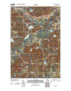
~ Bean Lake WI topo map, 1:24000 scale, 7.5 X 7.5 Minute, Historical, 2010
Bean Lake, Wisconsin, USGS topographic map dated 2010.
Includes geographic coordinates (latitude and longitude). This topographic map is suitable for hiking, camping, and exploring, or framing it as a wall map.
Printed on-demand using high resolution imagery, on heavy weight and acid free paper, or alternatively on a variety of synthetic materials.
Topos available on paper, Waterproof, Poly, or Tyvek. Usually shipping rolled, unless combined with other folded maps in one order.
- Product Number: USGS-5222086
- Free digital map download (high-resolution, GeoPDF): Bean Lake, Wisconsin (file size: 22 MB)
- Map Size: please refer to the dimensions of the GeoPDF map above
- Weight (paper map): ca. 55 grams
- Map Type: POD USGS Topographic Map
- Map Series: US Topo
- Map Verison: Historical
- Cell ID: 69283
- Datum: North American Datum of 1983
- Map Projection: Transverse Mercator
- Map Cell Name: Bean Lake
- Grid size: 7.5 X 7.5 Minute
- Date on map: 2010
- Map Scale: 1:24000
- Geographical region: Wisconsin, United States
Neighboring Maps:
All neighboring USGS topo maps are available for sale online at a variety of scales.
Spatial coverage:
Topo map Bean Lake, Wisconsin, covers the geographical area associated the following places:
- Town of Bass Lake - Flat Creek - Mud Lake - Colbroth Lake - Rainbow Creek - Stress Pit - Little Bean Brook - Loon Lake - Devils Lake - WHSM-AM (Hayward) - Edgewood School (historical) - Little Spring Lake - Spring Lake Creek - Flat Creek State Wildlife Management Area - Bean Lake - Mud Lake - Tripp Lake - Bean Brook State Wildlife Management Area - Saint Croix National Scenic Riverway - Beaver Lake - WHSM-FM (Hayward) - Jordon School (historical) - King Lake - Stinnett School (historical) - Brownlee School (historical)
- Map Area ID: AREA4645.875-91.625-91.5
- Northwest corner Lat/Long code: USGSNW46-91.625
- Northeast corner Lat/Long code: USGSNE46-91.5
- Southwest corner Lat/Long code: USGSSW45.875-91.625
- Southeast corner Lat/Long code: USGSSE45.875-91.5
- Northern map edge Latitude: 46
- Southern map edge Latitude: 45.875
- Western map edge Longitude: -91.625
- Eastern map edge Longitude: -91.5


