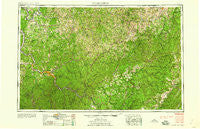
~ Charleston WV topo map, 1:250000 scale, 1 X 2 Degree, Historical, 1958, updated 1958
Charleston, West Virginia, USGS topographic map dated 1958.
Includes geographic coordinates (latitude and longitude). This topographic map is suitable for hiking, camping, and exploring, or framing it as a wall map.
Printed on-demand using high resolution imagery, on heavy weight and acid free paper, or alternatively on a variety of synthetic materials.
Topos available on paper, Waterproof, Poly, or Tyvek. Usually shipping rolled, unless combined with other folded maps in one order.
- Product Number: USGS-5416190
- Free digital map download (high-resolution, GeoPDF): Charleston, West Virginia (file size: 28 MB)
- Map Size: please refer to the dimensions of the GeoPDF map above
- Weight (paper map): ca. 55 grams
- Map Type: POD USGS Topographic Map
- Map Series: HTMC
- Map Verison: Historical
- Cell ID: 68709
- Scan ID: 254034
- Imprint Year: 1958
- Woodland Tint: Yes
- Aerial Photo Year: 1946
- Datum: Unstated
- Map Projection: Transverse Mercator
- Map published by United States Geological Survey
- Map Language: English
- Scanner Resolution: 600 dpi
- Map Cell Name: Charleston
- Grid size: 1 X 2 Degree
- Date on map: 1958
- Map Scale: 1:250000
- Geographical region: West Virginia, United States
Neighboring Maps:
All neighboring USGS topo maps are available for sale online at a variety of scales.
Spatial coverage:
Topo map Charleston, West Virginia, covers the geographical area associated the following places:
- Carver (historical) - Silica - Arborland Acres - Persinger - Winter - Greendale - Daysville - Fletcher - Arcola - Bigbend - Whittaker - Arnett - Caress - Kirkwood - Two Run - Maysel - Coopertown - Huntsville (historical) - Silver Valley Estates - Low Gap - Winifrede Junction - Kentuck - Tesla - Sutton - Sand Fork - Guardian - Jefferson - Lizemores - Van Camp - Julian - Flatwoods - Mayton (historical) - Grace - Knapp - Beech Glen - McDunn - Withers - Five Forks - Englewood Estates - Oldtown Flats - Pembroke - Liberty - Waneta - Ireland - Mulvane (historical) - Tallmansville - Virgil (historical) - Holcomb - Ash - Fraziers Bottom - Ravenseye - Dial - Glen - Walnut - Hemlock - Longacre - Liberty Hill - Pinch - Burning Springs - Sumerco - Joppa - Mount Hope - Giles - Orr - White Pine - Cameo - Turtle Creek - Tanner - Angerona - Belgrove - Jamestown (historical) - Nelson - River Bend - Cornelia - Frame - Riverside - Gip - Poplar Point Estates - Eleanor - Donlan - Normantown - Hugo - Mount Olive - Kincaid - Teays Valley Meadows - Middle Fork (historical) - Saxon - Staten - Tara Estates - Bickmore - Ulric - Chesapeake - Billings - The Ridge Estates - Trainer - Campbelltown - Corton - Russet - West Side - Ravenswood
- Map Area ID: AREA3938-82-80
- Northwest corner Lat/Long code: USGSNW39-82
- Northeast corner Lat/Long code: USGSNE39-80
- Southwest corner Lat/Long code: USGSSW38-82
- Southeast corner Lat/Long code: USGSSE38-80
- Northern map edge Latitude: 39
- Southern map edge Latitude: 38
- Western map edge Longitude: -82
- Eastern map edge Longitude: -80

