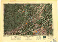
~ Bluefield WV topo map, 1:250000 scale, 1 X 2 Degree, Historical, 1955
Bluefield, West Virginia, USGS topographic map dated 1955.
Includes geographic coordinates (latitude and longitude). This topographic map is suitable for hiking, camping, and exploring, or framing it as a wall map.
Printed on-demand using high resolution imagery, on heavy weight and acid free paper, or alternatively on a variety of synthetic materials.
Topos available on paper, Waterproof, Poly, or Tyvek. Usually shipping rolled, unless combined with other folded maps in one order.
- Product Number: USGS-5416188
- Free digital map download (high-resolution, GeoPDF): Bluefield, West Virginia (file size: 21 MB)
- Map Size: please refer to the dimensions of the GeoPDF map above
- Weight (paper map): ca. 55 grams
- Map Type: POD USGS Topographic Map
- Map Series: HTMC
- Map Verison: Historical
- Cell ID: 68682
- Scan ID: 701713
- Woodland Tint: Yes
- Datum: Unstated
- Map Projection: Transverse Mercator
- Map published by United States Army
- Map Language: English
- Scanner Resolution: 508 dpi
- Map Cell Name: Bluefield
- Grid size: 1 X 2 Degree
- Date on map: 1955
- Map Scale: 1:250000
- Geographical region: West Virginia, United States
Neighboring Maps:
All neighboring USGS topo maps are available for sale online at a variety of scales.
Spatial coverage:
Topo map Bluefield, West Virginia, covers the geographical area associated the following places:
- Nimitz - Southside Hills - Moneiro - Rolling Hills - Riffe - Talking Leaves - Homeplace - McConnell - Ballard - Graysontown - Bevers Store (historical) - Craneco - Wingrove - Altoona Mines (historical) - Parrott - Metalton - Palestine - Beury - Montcalm - Niday - Belmont Estates - East Kingston - Wharncliffe - Rosedale - Hilldale - Capels - Iron Hill Springs - Eggleston - Glenvar - Yukon - Sylvia (historical) - Pardee - Craig Mountain - Argyle - Draper - Stroubles Mill - Marfork - Crag - Quail Crossing - McRoss - Apple Grove - Landville - Ethel - Potts Creek - Woodlyn - Blair - Mifflin - Rich Creek - Roland Terrace - Cumberland Heights - Cirtsville - Page - Simpkins Village - Laurel - Highfields - Sharples - McCoy - Marvin Garden Subdivision - McVey - Josephine - Greenwood (historical) - Backus - Crandon - Fort Donnally - Rollins Branch - Taplin - Oak Hill - Wilmont Park - Garwood - Mineral City - Tarkiln - Mount Vernon Heights - Hematite - Hotchkiss - Jenny Gap (historical) - Westward Lakes - Dennis - Pineknob - Arista - Cabell - Pettry - Lake Spring Land - Bennetts Mill - Cazy - Langhorne Place - Greenview - Rift - Salem Heights - Giatto - Marvin - Holly Brook - Mitchell - Oak Grove Farms - Lorton Lick - Hemlock - Heidelberg Estates - Herndon - Weirwood - Bald Knob - Thurmond
- Map Area ID: AREA3837-82-80
- Northwest corner Lat/Long code: USGSNW38-82
- Northeast corner Lat/Long code: USGSNE38-80
- Southwest corner Lat/Long code: USGSSW37-82
- Southeast corner Lat/Long code: USGSSE37-80
- Northern map edge Latitude: 38
- Southern map edge Latitude: 37
- Western map edge Longitude: -82
- Eastern map edge Longitude: -80

