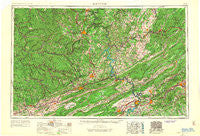
~ Bluefield WV topo map, 1:250000 scale, 1 X 2 Degree, Historical, 1957, updated 1967
Bluefield, West Virginia, USGS topographic map dated 1957.
Includes geographic coordinates (latitude and longitude). This topographic map is suitable for hiking, camping, and exploring, or framing it as a wall map.
Printed on-demand using high resolution imagery, on heavy weight and acid free paper, or alternatively on a variety of synthetic materials.
Topos available on paper, Waterproof, Poly, or Tyvek. Usually shipping rolled, unless combined with other folded maps in one order.
- Product Number: USGS-5416186
- Free digital map download (high-resolution, GeoPDF): Bluefield, West Virginia (file size: 19 MB)
- Map Size: please refer to the dimensions of the GeoPDF map above
- Weight (paper map): ca. 55 grams
- Map Type: POD USGS Topographic Map
- Map Series: HTMC
- Map Verison: Historical
- Cell ID: 68682
- Scan ID: 701712
- Imprint Year: 1967
- Woodland Tint: Yes
- Edit Year: 1966
- Field Check Year: 1957
- Datum: Unstated
- Map Projection: Transverse Mercator
- Map published by United States Geological Survey
- Map published by United States Army
- Map Language: English
- Scanner Resolution: 508 dpi
- Map Cell Name: Bluefield
- Grid size: 1 X 2 Degree
- Date on map: 1957
- Map Scale: 1:250000
- Geographical region: West Virginia, United States
Neighboring Maps:
All neighboring USGS topo maps are available for sale online at a variety of scales.
Spatial coverage:
Topo map Bluefield, West Virginia, covers the geographical area associated the following places:
- Robinette - Lillydale - Lawton - Clearview Heights - Lee - Bellepoint - Rocklick - Hickory Grove - Mountain Top Estates - Keister - Edgewood - Earlehurst - Smokeless - Tamcliff - Fairlawn - Jacobs Fork - West Junction - West Club Forest - Cirtsville - Grandview - Oak Park - Miller Addition - Grandview Gardens - Newport - Stonewall (historical) - Rosedale - Hilltop Plaza - Rogers - Basin - Jewell Valley - Blue Jay - Garland - McGlone - Adam Acres - Underwood Estates - Henlawson - Gladewood - Barranger - Teaberry - Hiawatha - Mount Olive - Country Club Estates - Lovern - Berton - Briar Ridge - City View Heights - Marnie - Marie - West Raven - Roxalia - Gilliam - Pinepoca (historical) - Secondcreek - Wyoming - Moneiro - Belle Heth - Pax - Buskirk Addition - Blake Forest - Little Montgomery - Piedmont - Bim - Chimney Hill Estates - New Richmond - Kanodes Mill - Clifftop - Glen Jean - Mullens - Sarah Ann - Pine Bluff - Jordan Mines - Beelick Knob - Kimball - Hemphill - Sharon Springs - Wedgewood Forest - West Logan - Kegley - Elgood - Neibert - Eads Mill - Fanrock - Ironto - Lerona - Fort Donnally - Pilot - Westward Lake Estates - Greenstown - Shenandoah - Freeze Fork - Lyburn - Piercys Mill - Brewsterdale - Homeplace - Oak Grove - Claypool - Auto - Hokes Mill - Whitcomb (historical) - Roanoke Red Sulphur Springs
- Map Area ID: AREA3837-82-80
- Northwest corner Lat/Long code: USGSNW38-82
- Northeast corner Lat/Long code: USGSNE38-80
- Southwest corner Lat/Long code: USGSSW37-82
- Southeast corner Lat/Long code: USGSSE37-80
- Northern map edge Latitude: 38
- Southern map edge Latitude: 37
- Western map edge Longitude: -82
- Eastern map edge Longitude: -80

