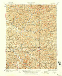
~ Ripley WV topo map, 1:62500 scale, 15 X 15 Minute, Historical, 1926, updated 1958
Ripley, West Virginia, USGS topographic map dated 1926.
Includes geographic coordinates (latitude and longitude). This topographic map is suitable for hiking, camping, and exploring, or framing it as a wall map.
Printed on-demand using high resolution imagery, on heavy weight and acid free paper, or alternatively on a variety of synthetic materials.
Topos available on paper, Waterproof, Poly, or Tyvek. Usually shipping rolled, unless combined with other folded maps in one order.
- Product Number: USGS-5415844
- Free digital map download (high-resolution, GeoPDF): Ripley, West Virginia (file size: 14 MB)
- Map Size: please refer to the dimensions of the GeoPDF map above
- Weight (paper map): ca. 55 grams
- Map Type: POD USGS Topographic Map
- Map Series: HTMC
- Map Verison: Historical
- Cell ID: 61632
- Scan ID: 253825
- Imprint Year: 1958
- Survey Year: 1905
- Datum: NAD27
- Map Projection: Polyconic
- Map published by United States Geological Survey
- Map Language: English
- Scanner Resolution: 600 dpi
- Map Cell Name: Ripley
- Grid size: 15 X 15 Minute
- Date on map: 1926
- Map Scale: 1:62500
- Geographical region: West Virginia, United States
Neighboring Maps:
All neighboring USGS topo maps are available for sale online at a variety of scales.
Spatial coverage:
Topo map Ripley, West Virginia, covers the geographical area associated the following places:
- Wilding - Nuzums - Murray - Buffalo (historical) - Cuba - McClain - Sidneyville - New Era - LeRoy - Sandy Summit - Independence - Lattimer - Nesselroad (historical) - Pleasant Hill - Marshall - Drift Run - Liverpool - Varner - Allentown - Gay - Sandyville - Antioch - Wiseburg - Louther - Duncan - Silverton - Ripley - Garfield - Mentor (historical) - Shatto - Hemlock - Lockhart - Hereford - Parchment Valley - Meadowdale - Oak Hill - Odaville - Skidmore - Jones Crossing - Nesselroad - Salt Hill - Medina - The Y - Fairplain
- Map Area ID: AREA3938.75-81.75-81.5
- Northwest corner Lat/Long code: USGSNW39-81.75
- Northeast corner Lat/Long code: USGSNE39-81.5
- Southwest corner Lat/Long code: USGSSW38.75-81.75
- Southeast corner Lat/Long code: USGSSE38.75-81.5
- Northern map edge Latitude: 39
- Southern map edge Latitude: 38.75
- Western map edge Longitude: -81.75
- Eastern map edge Longitude: -81.5