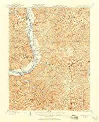
~ Glenwood WV topo map, 1:62500 scale, 15 X 15 Minute, Historical, 1906, updated 1958
Glenwood, West Virginia, USGS topographic map dated 1906.
Includes geographic coordinates (latitude and longitude). This topographic map is suitable for hiking, camping, and exploring, or framing it as a wall map.
Printed on-demand using high resolution imagery, on heavy weight and acid free paper, or alternatively on a variety of synthetic materials.
Topos available on paper, Waterproof, Poly, or Tyvek. Usually shipping rolled, unless combined with other folded maps in one order.
- Product Number: USGS-5415348
- Free digital map download (high-resolution, GeoPDF): Glenwood, West Virginia (file size: 13 MB)
- Map Size: please refer to the dimensions of the GeoPDF map above
- Weight (paper map): ca. 55 grams
- Map Type: POD USGS Topographic Map
- Map Series: HTMC
- Map Verison: Historical
- Cell ID: 54608
- Scan ID: 253553
- Imprint Year: 1958
- Survey Year: 1906
- Datum: Unstated
- Map Projection: Unstated
- Map published by United States Geological Survey
- Map Language: English
- Scanner Resolution: 600 dpi
- Map Cell Name: Gleenwood
- Grid size: 15 X 15 Minute
- Date on map: 1906
- Map Scale: 1:62500
- Geographical region: West Virginia, United States
Neighboring Maps:
All neighboring USGS topo maps are available for sale online at a variety of scales.
Spatial coverage:
Topo map Glenwood, West Virginia, covers the geographical area associated the following places:
- Veranda (historical) - Flaxton (historical) - Halley (historical) - Raccoon Island - Mohrtown - Gwinn - Swann - Dudley Gap - Pondlick - Bladen - Hogsett - Upland - Holiday Hills - Arlee - Angola (historical) - Ashton - Apple Grove - Thivener - Eureka - Condee (historical) - Clemma (historical) - Clover - Swan Creek - Mercers Bottom - Mount Olive - Glenwood
- Map Area ID: AREA38.7538.5-82.25-82
- Northwest corner Lat/Long code: USGSNW38.75-82.25
- Northeast corner Lat/Long code: USGSNE38.75-82
- Southwest corner Lat/Long code: USGSSW38.5-82.25
- Southeast corner Lat/Long code: USGSSE38.5-82
- Northern map edge Latitude: 38.75
- Southern map edge Latitude: 38.5
- Western map edge Longitude: -82.25
- Eastern map edge Longitude: -82