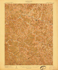
~ Glenville WV topo map, 1:62500 scale, 15 X 15 Minute, Historical, 1906
Glenville, West Virginia, USGS topographic map dated 1906.
Includes geographic coordinates (latitude and longitude). This topographic map is suitable for hiking, camping, and exploring, or framing it as a wall map.
Printed on-demand using high resolution imagery, on heavy weight and acid free paper, or alternatively on a variety of synthetic materials.
Topos available on paper, Waterproof, Poly, or Tyvek. Usually shipping rolled, unless combined with other folded maps in one order.
- Product Number: USGS-5415334
- Free digital map download (high-resolution, GeoPDF): Glenville, West Virginia (file size: 13 MB)
- Map Size: please refer to the dimensions of the GeoPDF map above
- Weight (paper map): ca. 55 grams
- Map Type: POD USGS Topographic Map
- Map Series: HTMC
- Map Verison: Historical
- Cell ID: 54624
- Scan ID: 253548
- Woodland Tint: Yes
- Survey Year: 1903
- Datum: Unstated
- Map Projection: Unstated
- Map published by United States Geological Survey
- Map Language: English
- Scanner Resolution: 600 dpi
- Map Cell Name: Glenville
- Grid size: 15 X 15 Minute
- Date on map: 1906
- Map Scale: 1:62500
- Geographical region: West Virginia, United States
Neighboring Maps:
All neighboring USGS topo maps are available for sale online at a variety of scales.
Spatial coverage:
Topo map Glenville, West Virginia, covers the geographical area associated the following places:
- Hope (historical) - Progress (historical) - Normantown - Latonia - German (historical) - Shock - Flower - Cedarville - Perkins - Withers - Cutlips - Glenville - Bennett (historical) - Kanawha Drive - Alice - Revore - Orton - Dora - Baldwin - Dusk - Truebada - Moss - Lucerne - Let (historical) - Lockney - Stumptown - De Kalb - Hardman - Tanner
- Map Area ID: AREA3938.75-81-80.75
- Northwest corner Lat/Long code: USGSNW39-81
- Northeast corner Lat/Long code: USGSNE39-80.75
- Southwest corner Lat/Long code: USGSSW38.75-81
- Southeast corner Lat/Long code: USGSSE38.75-80.75
- Northern map edge Latitude: 39
- Southern map edge Latitude: 38.75
- Western map edge Longitude: -81
- Eastern map edge Longitude: -80.75