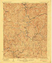
~ Gilbert WV topo map, 1:62500 scale, 15 X 15 Minute, Historical, 1925
Gilbert, West Virginia, USGS topographic map dated 1925.
Includes geographic coordinates (latitude and longitude). This topographic map is suitable for hiking, camping, and exploring, or framing it as a wall map.
Printed on-demand using high resolution imagery, on heavy weight and acid free paper, or alternatively on a variety of synthetic materials.
Topos available on paper, Waterproof, Poly, or Tyvek. Usually shipping rolled, unless combined with other folded maps in one order.
- Product Number: USGS-5415320
- Free digital map download (high-resolution, GeoPDF): Gilbert, West Virginia (file size: 12 MB)
- Map Size: please refer to the dimensions of the GeoPDF map above
- Weight (paper map): ca. 55 grams
- Map Type: POD USGS Topographic Map
- Map Series: HTMC
- Map Verison: Historical
- Cell ID: 54569
- Scan ID: 253545
- Survey Year: 1909
- Datum: NAD
- Map Projection: Polyconic
- Map published by United States Geological Survey
- Map Language: English
- Scanner Resolution: 600 dpi
- Map Cell Name: Gilbert
- Grid size: 15 X 15 Minute
- Date on map: 1925
- Map Scale: 1:62500
- Geographical region: West Virginia, United States
Neighboring Maps:
All neighboring USGS topo maps are available for sale online at a variety of scales.
Spatial coverage:
Topo map Gilbert, West Virginia, covers the geographical area associated the following places:
- Emmett - Big Branch - Steeles - Glen Alum Junction - Ikes Fork - Justice - Huff Junction - Verner - Sharon Heights - Sarah Ann - Mohawk - Gillman Bottom - Slabtown - Bruno - North Spring - Long Branch - Glen Alum - Cub City - Tamcliff - Mineral City - Horsepen (historical) - Wylo - Gilbert Creek - Mallory - Gilbert - Baisden - Greenville - Christian - Sprattsville - Hensley Heights - Leatherwood - Don - Hampden - Crystal Block - Longpole - Hanover - Davin - Wharncliffe - Wyoming City - War Eagle - Man - Superior Bottom - Guyan - Claypool - Landville - Isaban - Combs Addition
- Map Area ID: AREA37.7537.5-82-81.75
- Northwest corner Lat/Long code: USGSNW37.75-82
- Northeast corner Lat/Long code: USGSNE37.75-81.75
- Southwest corner Lat/Long code: USGSSW37.5-82
- Southeast corner Lat/Long code: USGSSE37.5-81.75
- Northern map edge Latitude: 37.75
- Southern map edge Latitude: 37.5
- Western map edge Longitude: -82
- Eastern map edge Longitude: -81.75