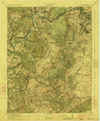
~ Alderson WV topo map, 1:62500 scale, 15 X 15 Minute, Historical, 1923
Alderson, West Virginia, USGS topographic map dated 1923.
Includes geographic coordinates (latitude and longitude). This topographic map is suitable for hiking, camping, and exploring, or framing it as a wall map.
Printed on-demand using high resolution imagery, on heavy weight and acid free paper, or alternatively on a variety of synthetic materials.
Topos available on paper, Waterproof, Poly, or Tyvek. Usually shipping rolled, unless combined with other folded maps in one order.
- Product Number: USGS-5414878
- Free digital map download (high-resolution, GeoPDF): Alderson, West Virginia (file size: 11 MB)
- Map Size: please refer to the dimensions of the GeoPDF map above
- Weight (paper map): ca. 55 grams
- Map Type: POD USGS Topographic Map
- Map Series: HTMC
- Map Verison: Historical
- Cell ID: 50409
- Scan ID: 253316
- Woodland Tint: Yes
- Visual Version Number: 1
- Survey Year: 1921
- Datum: NAD
- Map Projection: Polyconic
- Map published by United States Geological Survey
- Map Language: English
- Scanner Resolution: 600 dpi
- Map Cell Name: Alderson
- Grid size: 15 X 15 Minute
- Date on map: 1923
- Map Scale: 1:62500
- Geographical region: West Virginia, United States
Neighboring Maps:
All neighboring USGS topo maps are available for sale online at a variety of scales.
Spatial coverage:
Topo map Alderson, West Virginia, covers the geographical area associated the following places:
- Valley Heights - Wikel - Nickells Mill - Knobs - Ballengee - Wolfcreek - Santafee - Hokes Mill - Johnson Crossroads - Santifee (historical) - Sinks Grove - Wayside - Creamery - Clayton - Lillydale - Snowflake - Palestine - Half Way - Fort Spring - Greenville - Lowell - Raines Corner - Glenray - Griffith Creek - Elmhurst - Union - Riffe - Zenith - Rockland - Sarton - Frazier - Pence Springs - Barnettown - Willow Bend - Pickaway - Egypt (historical) - Alderson - Salt Sulphur Springs
- Map Area ID: AREA37.7537.5-80.75-80.5
- Northwest corner Lat/Long code: USGSNW37.75-80.75
- Northeast corner Lat/Long code: USGSNE37.75-80.5
- Southwest corner Lat/Long code: USGSSW37.5-80.75
- Southeast corner Lat/Long code: USGSSE37.5-80.5
- Northern map edge Latitude: 37.75
- Southern map edge Latitude: 37.5
- Western map edge Longitude: -80.75
- Eastern map edge Longitude: -80.5