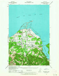
~ Dungeness WA topo map, 1:62500 scale, 15 X 15 Minute, Historical, 1938, updated 1964
Dungeness, Washington, USGS topographic map dated 1938.
Includes geographic coordinates (latitude and longitude). This topographic map is suitable for hiking, camping, and exploring, or framing it as a wall map.
Printed on-demand using high resolution imagery, on heavy weight and acid free paper, or alternatively on a variety of synthetic materials.
Topos available on paper, Waterproof, Poly, or Tyvek. Usually shipping rolled, unless combined with other folded maps in one order.
- Product Number: USGS-5409756
- Free digital map download (high-resolution, GeoPDF): Dungeness, Washington (file size: 8 MB)
- Map Size: please refer to the dimensions of the GeoPDF map above
- Weight (paper map): ca. 55 grams
- Map Type: POD USGS Topographic Map
- Map Series: HTMC
- Map Verison: Historical
- Cell ID: 53596
- Scan ID: 240898
- Imprint Year: 1964
- Woodland Tint: Yes
- Aerial Photo Year: 1938
- Datum: NAD27
- Map Projection: Polyconic
- Map published by United States Army Corps of Engineers
- Map published by United States Department of War
- Map Language: English
- Scanner Resolution: 600 dpi
- Map Cell Name: Dungeness
- Grid size: 15 X 15 Minute
- Date on map: 1938
- Map Scale: 1:62500
- Geographical region: Washington, United States
Neighboring Maps:
All neighboring USGS topo maps are available for sale online at a variety of scales.
Spatial coverage:
Topo map Dungeness, Washington, covers the geographical area associated the following places:
- Avellana Mobile Home Park - Spruce West Mobile Home Park - Lazy Acres Mobile Home Park - Blyn - Carlsborg Mobile Estates - Sunnyside Mobile Court - Parkwood Mobile Home Community - Washington Harbor - River Road - Dungeness - Agnew Mobile Home Park - Bell Hill - Hendrickson Heritage Mobile Home Park - Green Acres Mobile Estates - Juniper Mobile Estates - Rena - Cedar Grove Mobile Home Park - Sequim - Dukes Mobile Home Park - Jamestown - Port Williams - Happy Valley - Hide Away Mobile Home Park - Sequim West Mobile Home Park - West Alder Mobile Home Park - Carlsborg - Clasen Cove Estates Mobile Home Park - Baywood Village Mobile Home Park - City Center Mobile Home Park - Old Town - Agnew
- Map Area ID: AREA48.2548-123.25-123
- Northwest corner Lat/Long code: USGSNW48.25-123.25
- Northeast corner Lat/Long code: USGSNE48.25-123
- Southwest corner Lat/Long code: USGSSW48-123.25
- Southeast corner Lat/Long code: USGSSE48-123
- Northern map edge Latitude: 48.25
- Southern map edge Latitude: 48
- Western map edge Longitude: -123.25
- Eastern map edge Longitude: -123