
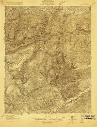
~ Wise VA topo map, 1:48000 scale, 15 X 15 Minute, Historical, 1920
Wise, Virginia, USGS topographic map dated 1920.
Includes geographic coordinates (latitude and longitude). This topographic map is suitable for hiking, camping, and exploring, or framing it as a wall map.
Printed on-demand using high resolution imagery, on heavy weight and acid free paper, or alternatively on a variety of synthetic materials.
Topos available on paper, Waterproof, Poly, or Tyvek. Usually shipping rolled, unless combined with other folded maps in one order.
- Product Number: USGS-5659918
- Free digital map download (high-resolution, GeoPDF): Wise, Virginia (file size: 16 MB)
- Map Size: please refer to the dimensions of the GeoPDF map above
- Weight (paper map): ca. 55 grams
- Map Type: POD USGS Topographic Map
- Map Series: HTMC
- Map Verison: Historical
- Cell ID: 64658
- Scan ID: 187765
- Survey Year: 1916
- Datum: Unstated
- Map Projection: Unstated
- Advance: Yes
- Map published by United States Geological Survey
- Keywords: Nonstandard Press Run; Overedge
- Map Language: English
- Scanner Resolution: 600 dpi
- Map Cell Name: Wise
- Grid size: 15 X 15 Minute
- Date on map: 1920
- Map Scale: 1:48000
- Geographical region: Virginia, United States
Neighboring Maps:
All neighboring USGS topo maps are available for sale online at a variety of scales.
Spatial coverage:
Topo map Wise, Virginia, covers the geographical area associated the following places:
- Tacoma - Blackwood - Roaring Fork - Hawthorne - Canepatch (historical) - Roundstone - Ramsey - Stephens - Grays Ford - Fort Blackmore - Needmore - Three Forks - Wood - Clear Creek (historical) - Lano - East Stone Gap - Riggs (historical) - Duncan Mill - Dunbar - Stanleytown - Dooley - Big Stone Gap - Graden - Laurel Grove - Cracker Neck - Josephine - Grays - Kerns - Norton - Addington - Dorchester - Mintons Store - Glamorgan - Cox Place - Esserville - Sutherland - Valaho (historical) - Wise - Verdi - Kent Junction - Dorchester Junction - Wells - Hamilton Town
- Map Area ID: AREA3736.75-82.75-82.5
- Northwest corner Lat/Long code: USGSNW37-82.75
- Northeast corner Lat/Long code: USGSNE37-82.5
- Southwest corner Lat/Long code: USGSSW36.75-82.75
- Southeast corner Lat/Long code: USGSSE36.75-82.5
- Northern map edge Latitude: 37
- Southern map edge Latitude: 36.75
- Western map edge Longitude: -82.75
- Eastern map edge Longitude: -82.5


