
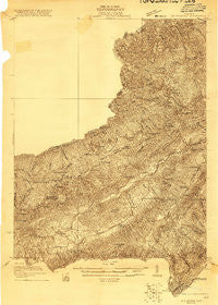
~ Big Stone Gap VA topo map, 1:48000 scale, 15 X 15 Minute, Historical, 1921
Big Stone Gap, Virginia, USGS topographic map dated 1921.
Includes geographic coordinates (latitude and longitude). This topographic map is suitable for hiking, camping, and exploring, or framing it as a wall map.
Printed on-demand using high resolution imagery, on heavy weight and acid free paper, or alternatively on a variety of synthetic materials.
Topos available on paper, Waterproof, Poly, or Tyvek. Usually shipping rolled, unless combined with other folded maps in one order.
- Product Number: USGS-5659710
- Free digital map download (high-resolution, GeoPDF): Big Stone Gap, Virginia (file size: 17 MB)
- Map Size: please refer to the dimensions of the GeoPDF map above
- Weight (paper map): ca. 55 grams
- Map Type: POD USGS Topographic Map
- Map Series: HTMC
- Map Verison: Historical
- Cell ID: 51385
- Scan ID: 187657
- Survey Year: 1920
- Datum: NAD
- Map Projection: Polyconic
- Advance: Yes
- Map published by United States Geological Survey
- Keywords: Nonstandard Press Run; Overedge
- Map Language: English
- Scanner Resolution: 600 dpi
- Map Cell Name: Big Stone Gap
- Grid size: 15 X 15 Minute
- Date on map: 1921
- Map Scale: 1:48000
- Geographical region: Virginia, United States
Neighboring Maps:
All neighboring USGS topo maps are available for sale online at a variety of scales.
Spatial coverage:
Topo map Big Stone Gap, Virginia, covers the geographical area associated the following places:
- Mill Branch (historical) - Olinger - Appalachia - Cumberland - Deep Springs - Buckles (historical) - Clark (historical) - Mohawk (historical) - Beechwood (historical) - Clutts - Rawhide - Sigma - Irondale - Blair - Harvey - Seminary - Exeter - Darnell Town - Andover - Purcell - Harper - Derby - Benham - Laurel - Ely - Beamantown - Johnsons Mill (historical) - Keokee - Oreton - Arno - Goodloe (historical) - Newtown - Pughs - Linden - Imboden - Jasper - Roda - Inman - Delvale - Osaka - Calvin - Shepherd Hill - Tito - Lower Exeter - Bundy - Stonega - Lynch - Robbins (historical) - Clover - Cadet - Dryden
- Map Area ID: AREA3736.75-83-82.75
- Northwest corner Lat/Long code: USGSNW37-83
- Northeast corner Lat/Long code: USGSNE37-82.75
- Southwest corner Lat/Long code: USGSSW36.75-83
- Southeast corner Lat/Long code: USGSSE36.75-82.75
- Northern map edge Latitude: 37
- Southern map edge Latitude: 36.75
- Western map edge Longitude: -83
- Eastern map edge Longitude: -82.75


