
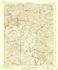
~ Aylett VA topo map, 1:62500 scale, 15 X 15 Minute, Historical, 1933, updated 1933
Aylett, Virginia, USGS topographic map dated 1933.
Includes geographic coordinates (latitude and longitude). This topographic map is suitable for hiking, camping, and exploring, or framing it as a wall map.
Printed on-demand using high resolution imagery, on heavy weight and acid free paper, or alternatively on a variety of synthetic materials.
Topos available on paper, Waterproof, Poly, or Tyvek. Usually shipping rolled, unless combined with other folded maps in one order.
- Product Number: USGS-5631343
- Free digital map download (high-resolution, GeoPDF): Aylett, Virginia (file size: 8 MB)
- Map Size: please refer to the dimensions of the GeoPDF map above
- Weight (paper map): ca. 55 grams
- Map Type: POD USGS Topographic Map
- Map Series: HTMC
- Map Verison: Historical
- Cell ID: 50827
- Scan ID: 187801
- Imprint Year: 1933
- Survey Year: 1917
- Datum: NAD
- Map Projection: Polyconic
- Map published by United States Army Corps of Engineers
- Map published by United States Department of War
- Map Language: English
- Scanner Resolution: 600 dpi
- Map Cell Name: Aylett
- Grid size: 15 X 15 Minute
- Date on map: 1933
- Map Scale: 1:62500
- Geographical region: Virginia, United States
Neighboring Maps:
All neighboring USGS topo maps are available for sale online at a variety of scales.
Spatial coverage:
Topo map Aylett, Virginia, covers the geographical area associated the following places:
- Poplar Landing - Midway - Pollards Corner - Beale (historical) - Aylett Mill - Butlers Fork - Epworth - Beulahville - Cape Charlie - Gether - Bagby - Duane Fork - Beazley - Upshaw - Owenton - Cauthornville - Corinth Fork - Sorrell - Indian Neck - Venter - Central Point - Rosespout - Newtown - Aylett - Elevon - Pointers Landing - Broadus Corner - Helmet - Battery - Lauraville - Beverly - Turpin - Salvia - Sparta - Biscoe - Tignor - Duane - Globe
- Map Area ID: AREA3837.75-77.25-77
- Northwest corner Lat/Long code: USGSNW38-77.25
- Northeast corner Lat/Long code: USGSNE38-77
- Southwest corner Lat/Long code: USGSSW37.75-77.25
- Southeast corner Lat/Long code: USGSSE37.75-77
- Northern map edge Latitude: 38
- Southern map edge Latitude: 37.75
- Western map edge Longitude: -77.25
- Eastern map edge Longitude: -77


