
~ Amelia VA topo map, 1:125000 scale, 30 X 30 Minute, Historical, 1897, updated 1904
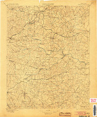
Amelia, Virginia, USGS topographic map dated 1897.
Includes geographic coordinates (latitude and longitude). This topographic map is suitable for hiking, camping, and exploring, or framing it as a wall map.
Printed on-demand using high resolution imagery, on heavy weight and acid free paper, or alternatively on a variety of synthetic materials.
Topos available on paper, Waterproof, Poly, or Tyvek. Usually shipping rolled, unless combined with other folded maps in one order.
- Product Number: USGS-5303728
- Free digital map download (high-resolution, GeoPDF): Amelia, Virginia (file size: 8 MB)
- Map Size: please refer to the dimensions of the GeoPDF map above
- Weight (paper map): ca. 55 grams
- Map Type: POD USGS Topographic Map
- Map Series: HTMC
- Map Verison: Historical
- Cell ID: 64882
- Scan ID: 188838
- Imprint Year: 1904
- Survey Year: 1895
- Datum: Unstated
- Map Projection: Unstated
- Map published by United States Geological Survey
- Map Language: English
- Scanner Resolution: 600 dpi
- Map Cell Name: Amelia
- Grid size: 30 X 30 Minute
- Date on map: 1897
- Map Scale: 1:125000
- Geographical region: Virginia, United States
Neighboring Maps:
All neighboring USGS topo maps are available for sale online at a variety of scales.
Spatial coverage:
Topo map Amelia, Virginia, covers the geographical area associated the following places:
- Lakewood - Otterburn - Dinwiddie Acres - Runnymede - Mayfair Estates - Mannboro - North Wellville - Denaro - Deerfield Estates - Laird (historical) - Fieldstown - Otterdale - Kempis (historical) - Chestnut Hill - Colina (historical) - Qualla Farms - Westboro (historical) - Rolling Hills - Jack - Winterham - Fairpines - Walkers - Matoaca (historical) - Woodlake - Ford - Moseley - Holly (historical) - Rocky Run - Coalboro (historical) - Giles Mill - Clays Corner - Butterworth - Sandy Ridge - Kragmont - Pilkinton - Wedgewood - Spainville - Beverly Acres - Hallsboro - Hebron - Masons Corner - Nuttree (historical) - Confederate Woods - Burgess - Amelia Court House - Mattoax - Hylton Park - Dabney Estates - Nash Grove - Hunters Green - Wilsons - Wiseville (historical) - Clayville - Longwood Acres - Dinwiddie - Stony Springs - Genito Estates - Fendley (historical) - Goode Crossing - Zoar (historical) - Arrowhead - Leader - Old Coach Hills - Manchester - Scotts Fork - Oldenplace (historical) - Genito - Oakhaven Farms - Shannon Terrace - Addison - Brandermill - Earls - Darvills - Ammon - Worthington Farms - Oak Hill Estates - Namozine - Land O'Pines - Jessup Farm Acres - Baltimore Corner - Summit - Swift Creek Farms - Five Forks (historical) - Falling Creek Farms - Wilkinson Terrace - Sutherland - Marmona - Waldemar (historical) - Forkland (historical) - Skinquarter - Penmar Estates - Chesterfield Court House - Winterpock - Five Forks - Clay Estates - Coverly - Blackstone - Wellville - Eppes Falls (historical) - Sutherland Manor
- Map Area ID: AREA37.537-78-77.5
- Northwest corner Lat/Long code: USGSNW37.5-78
- Northeast corner Lat/Long code: USGSNE37.5-77.5
- Southwest corner Lat/Long code: USGSSW37-78
- Southeast corner Lat/Long code: USGSSE37-77.5
- Northern map edge Latitude: 37.5
- Southern map edge Latitude: 37
- Western map edge Longitude: -78
- Eastern map edge Longitude: -77.5


