
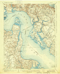
~ Yorktown VA topo map, 1:62500 scale, 15 X 15 Minute, Historical, 1907, updated 1932
Yorktown, Virginia, USGS topographic map dated 1907.
Includes geographic coordinates (latitude and longitude). This topographic map is suitable for hiking, camping, and exploring, or framing it as a wall map.
Printed on-demand using high resolution imagery, on heavy weight and acid free paper, or alternatively on a variety of synthetic materials.
Topos available on paper, Waterproof, Poly, or Tyvek. Usually shipping rolled, unless combined with other folded maps in one order.
- Product Number: USGS-5303612
- Free digital map download (high-resolution, GeoPDF): Yorktown, Virginia (file size: 8 MB)
- Map Size: please refer to the dimensions of the GeoPDF map above
- Weight (paper map): ca. 55 grams
- Map Type: POD USGS Topographic Map
- Map Series: HTMC
- Map Verison: Historical
- Cell ID: 64804
- Scan ID: 188758
- Imprint Year: 1932
- Survey Year: 1905
- Datum: NAD
- Map Projection: Polyconic
- Map published by United States Geological Survey
- Map Language: English
- Scanner Resolution: 600 dpi
- Map Cell Name: Yorktown
- Grid size: 15 X 15 Minute
- Date on map: 1907
- Map Scale: 1:62500
- Geographical region: Virginia, United States
Neighboring Maps:
All neighboring USGS topo maps are available for sale online at a variety of scales.
Spatial coverage:
Topo map Yorktown, Virginia, covers the geographical area associated the following places:
- Woods Run - Pauls Trailer Park - Chippokes - Oriana - Lawson - Hollybrook - Bradmere - Grove - Denbigh Mobile Home Park - Baileys Beach - Kingsmill on the James - Kingswood - Septa - Genovar - Carriage Hill - Holly Point - Homewood - Watergate Estates - Zooks Trailer Court - Kingspoint - Oyster Point - Windy Hill Mobile Home Park - Nicewood - Red Hill Village - Menchville - Deep Creek - Burwell Bay - Wendwood - Hidenwood - Cliveden - Mammoth Oak - Chesapeake Village Mobile Home Park - Beechmont - Lackey - Mennonite Colony - Skiffes Creek Annex - Shore Park - Mogarts Beach - Poplar Hall Plantation - Moonlight - Hoopes Landing - Windsor Great Park - Eastwood - Rushmere - Maple Grove - Collards Mobile Home Park - Birchwood Park - Country Village Mobile Home Park - Highgate - Burkdale - Yorktown - Hickory Hill - Maxwell Garden - Chelsea - College Park - Boxley Hills - Merry Point Estates - Poolesville - Edgewood - Hanover Heights - Blacksmith Corner - Booth - The Colony - Country Club Acres - Warwick Lawns - Denbigh - Barclay Woods - Patricia Heights - Beechwood - Beverly Hills - Tylers Beach - Rochambeau Village - Rushmere Shores - Trailux Mobile Village - Sawmill Corner - Torrey Pines Mobile Home Park - Walden - Old Orchard - Heritage Mobile Home Park - Lee Hall - Pooles Mobile Home Park - Porter Mobile Home Park - Stoney Brook Estates - Merry Oaks - Edgemoor - Pates Field (historical) - Americana Park East Mobile Home Park
- Map Area ID: AREA37.2537-76.75-76.5
- Northwest corner Lat/Long code: USGSNW37.25-76.75
- Northeast corner Lat/Long code: USGSNE37.25-76.5
- Southwest corner Lat/Long code: USGSSW37-76.75
- Southeast corner Lat/Long code: USGSSE37-76.5
- Northern map edge Latitude: 37.25
- Southern map edge Latitude: 37
- Western map edge Longitude: -76.75
- Eastern map edge Longitude: -76.5


