
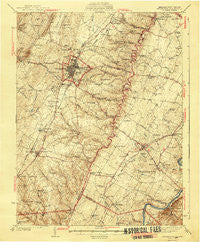
~ Winchester VA topo map, 1:62500 scale, 15 X 15 Minute, Historical, 1942
Winchester, Virginia, USGS topographic map dated 1942.
Includes geographic coordinates (latitude and longitude). This topographic map is suitable for hiking, camping, and exploring, or framing it as a wall map.
Printed on-demand using high resolution imagery, on heavy weight and acid free paper, or alternatively on a variety of synthetic materials.
Topos available on paper, Waterproof, Poly, or Tyvek. Usually shipping rolled, unless combined with other folded maps in one order.
- Product Number: USGS-5303596
- Free digital map download (high-resolution, GeoPDF): Winchester, Virginia (file size: 8 MB)
- Map Size: please refer to the dimensions of the GeoPDF map above
- Weight (paper map): ca. 55 grams
- Map Type: POD USGS Topographic Map
- Map Series: HTMC
- Map Verison: Historical
- Cell ID: 64608
- Scan ID: 188749
- Survey Year: 1937
- Datum: NAD27
- Map Projection: Polyconic
- Map published by United States Geological Survey
- Map Language: English
- Scanner Resolution: 600 dpi
- Map Cell Name: Winchester
- Grid size: 15 X 15 Minute
- Date on map: 1942
- Map Scale: 1:62500
- Geographical region: Virginia, United States
Neighboring Maps:
All neighboring USGS topo maps are available for sale online at a variety of scales.
Spatial coverage:
Topo map Winchester, Virginia, covers the geographical area associated the following places:
- Country Club Estates - Chapel Estates - Nineveh - Burnt Factory - Heritage Hills - Jordan Springs - Stonewall Orchard - Saratoga - Briggs - Ridings Mill - Brentwood Terrace - Bethel - Mount Pleasant - Pyletown - Lake Frederick - Winchester - Valley Acres - Reliance - Lost Corner - Blue Ridge Mobile Home Park - Ashby - Plainfield Heights - Round Hill - Swimley - Kernstown - Sunnyside - Klines Mill - Hill Crest - Fairway Estates - Claytonville - Gun Barrel Lane Estates - Spring Meadows Trailer Park - Bartonsville - Opequon - Echo Village - Senseny Heights - Leetown - Keeneland - Ash Hollow Estates - Freyco - Jackson Woods - Woodchuck Heights - Bufflick Heights - Wamplers Trailer Park - Chambersville - Greenway Court - College Park - Canterburg - Shenandoah Mobile Home Park - Southview - Frederick Heights - Stephens City - Greenwood Heights - North Frederick Terrace - Arcadia Mobile Home Park - Brookneil - Burning Knolls - Waterloo Heights - Westwood - Nain - Wadesville - Green Acres - White Post - Stephenson - Rolling Fields - Parkins Mills - Boyce - Day - Mar Village - Milldale - Blue Ridge Downs - Stonebrook Farms - Rock Hall - Shenandoah Hills - Payne Mobile Home Park - Greenway Estates - Tulip - Cather Estates - Country Park - Dearmont Chase - Millwood - Keystone Estates - Albin - Miller Heights - Spring Valley - Vaucluse - Bunker Hill - Sherwood Forest - Waterloo - Armel - Wellington Acres
- Map Area ID: AREA39.2539-78.25-78
- Northwest corner Lat/Long code: USGSNW39.25-78.25
- Northeast corner Lat/Long code: USGSNE39.25-78
- Southwest corner Lat/Long code: USGSSW39-78.25
- Southeast corner Lat/Long code: USGSSE39-78
- Northern map edge Latitude: 39.25
- Southern map edge Latitude: 39
- Western map edge Longitude: -78.25
- Eastern map edge Longitude: -78


