
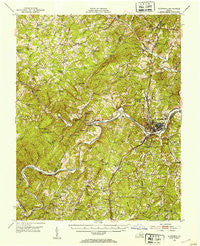
~ Altavista VA topo map, 1:62500 scale, 15 X 15 Minute, Historical, 1951, updated 1953
Altavista, Virginia, USGS topographic map dated 1951.
Includes geographic coordinates (latitude and longitude). This topographic map is suitable for hiking, camping, and exploring, or framing it as a wall map.
Printed on-demand using high resolution imagery, on heavy weight and acid free paper, or alternatively on a variety of synthetic materials.
Topos available on paper, Waterproof, Poly, or Tyvek. Usually shipping rolled, unless combined with other folded maps in one order.
- Product Number: USGS-5302538
- Free digital map download (high-resolution, GeoPDF): Altavista, Virginia (file size: 11 MB)
- Map Size: please refer to the dimensions of the GeoPDF map above
- Weight (paper map): ca. 55 grams
- Map Type: POD USGS Topographic Map
- Map Series: HTMC
- Map Verison: Historical
- Cell ID: 50467
- Scan ID: 187776
- Imprint Year: 1953
- Woodland Tint: Yes
- Aerial Photo Year: 1949
- Field Check Year: 1951
- Datum: NAD27
- Map Projection: Polyconic
- Map published by United States Geological Survey
- Map Language: English
- Scanner Resolution: 600 dpi
- Map Cell Name: Altavista
- Grid size: 15 X 15 Minute
- Date on map: 1951
- Map Scale: 1:62500
- Geographical region: Virginia, United States
Neighboring Maps:
All neighboring USGS topo maps are available for sale online at a variety of scales.
Spatial coverage:
Topo map Altavista, Virginia, covers the geographical area associated the following places:
- Huddleston - Lynch Station - Chestnut Fork - Gillespie - Browntown - Leesville - Beverly Heights - Lakewood - Holly Hills South - Hill Grove - Sycamore - Valley View Heights - Pine Ridge - Woodford Corner - Altavista - Mount Airy - Seminole Ridge - Evington - Moseley Heights - Brights - Hurt - Motley - Mentow - Forest Hill - Brutus
- Map Area ID: AREA37.2537-79.5-79.25
- Northwest corner Lat/Long code: USGSNW37.25-79.5
- Northeast corner Lat/Long code: USGSNE37.25-79.25
- Southwest corner Lat/Long code: USGSSW37-79.5
- Southeast corner Lat/Long code: USGSSE37-79.25
- Northern map edge Latitude: 37.25
- Southern map edge Latitude: 37
- Western map edge Longitude: -79.5
- Eastern map edge Longitude: -79.25


