
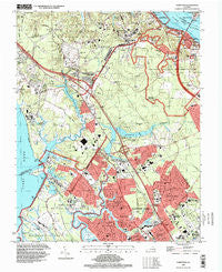
~ Yorktown VA topo map, 1:24000 scale, 7.5 X 7.5 Minute, Historical, 1994, updated 1999
Yorktown, Virginia, USGS topographic map dated 1994.
Includes geographic coordinates (latitude and longitude). This topographic map is suitable for hiking, camping, and exploring, or framing it as a wall map.
Printed on-demand using high resolution imagery, on heavy weight and acid free paper, or alternatively on a variety of synthetic materials.
Topos available on paper, Waterproof, Poly, or Tyvek. Usually shipping rolled, unless combined with other folded maps in one order.
- Product Number: USGS-5302164
- Free digital map download (high-resolution, GeoPDF): Yorktown, Virginia (file size: 12 MB)
- Map Size: please refer to the dimensions of the GeoPDF map above
- Weight (paper map): ca. 55 grams
- Map Type: POD USGS Topographic Map
- Map Series: HTMC
- Map Verison: Historical
- Cell ID: 50137
- Scan ID: 187332
- Imprint Year: 1999
- Woodland Tint: Yes
- Aerial Photo Year: 1994
- Datum: NAD83
- Map Projection: Universal Transverse Mercator
- Map published by United States Geological Survey
- Map Language: English
- Scanner Resolution: 600 dpi
- Map Cell Name: Yorktown
- Grid size: 7.5 X 7.5 Minute
- Date on map: 1994
- Map Scale: 1:24000
- Geographical region: Virginia, United States
Neighboring Maps:
All neighboring USGS topo maps are available for sale online at a variety of scales.
Spatial coverage:
Topo map Yorktown, Virginia, covers the geographical area associated the following places:
- Skiffes Creek Annex - Chelsea - Patricia Heights - Edgemoor - Zooks Trailer Court - Booth - Woods Run - Windsor Great Park - Heritage Mobile Home Park - Cliveden - Torrey Pines Mobile Home Park - Country Village Mobile Home Park - Lee Hall - Oriana - Stoney Brook Estates - Collards Mobile Home Park - Denbigh - Beechwood - Windy Hill Mobile Home Park - Sawmill Corner - Blacksmith Corner - Poplar Hall Plantation - Yorktown - Trailux Mobile Village - Beechmont - Hickory Hill - Rochambeau Village - Denbigh Mobile Home Park - Porter Mobile Home Park - Lackey - Pauls Trailer Park - Merry Oaks - Hanover Heights - Bradmere - Americana Park East Mobile Home Park - Red Hill Village
- Map Area ID: AREA37.2537.125-76.625-76.5
- Northwest corner Lat/Long code: USGSNW37.25-76.625
- Northeast corner Lat/Long code: USGSNE37.25-76.5
- Southwest corner Lat/Long code: USGSSW37.125-76.625
- Southeast corner Lat/Long code: USGSSE37.125-76.5
- Northern map edge Latitude: 37.25
- Southern map edge Latitude: 37.125
- Western map edge Longitude: -76.625
- Eastern map edge Longitude: -76.5


