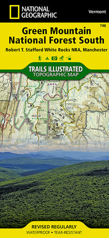
Green Mountain Natl Forest, White Rocks NRA, Manchester, Map 748 by National Geographic Maps
• Waterproof • Tear-Resistant • Topographic Map
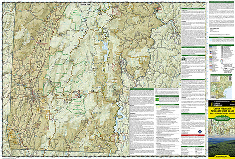
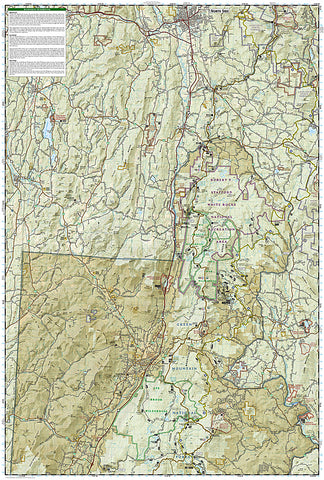
National Geographics Trails Illustrated map of Green Mountain National Forest South is the perfect travel companion for outdoor enthusiasts seeking to enjoy the four season recreation experience of the area. Expertly researched and created in cooperation with the U.S. Forest Service and others, the map delivers extensive detail of the forest from the city of Rutland to its southern boundary and includes such popular points of interest as Robert T. Stafford White Rocks National Recreation Area; Coolidge State Forest; Big Branch, Lye Brook, Glastenbury, George D. Aiken and Peru Peak Wilderness Areas; Killington, Mount Snow and Stratton Mountain Ski Areas; Harriman and Somerset Reservoirs; and Jamaica and Lake Shaftsbury State Parks.
Follow clearly mapped trails, marked for hiking, biking or horseback riding use, as you explore the area. The Appalachian and Long Trails, which merge, are highlighted as is the Catamount Trail. Non-motorized winter use trails are marked as well. To aid in your navigation, the map shows contour lines, elevations, labeled peaks, water features, areas of wooded cover, selected waypoints and color-coded land management boundaries. Recreation features for all season are labeled, including campgrounds, shelters, swimming and fishing areas, downhill and cross-country ski areas, ski jumps and scenic viewpoints. The map also provides background information of the forest and the wilderness areas, regulations, safety tips and contact information.
- Product Number: 2053342M
- Product Code: TI_GRNMTN_S
- Publisher Product ID: TI00000748
- ISBN: 9781566955126
- Year of Publication: 2010
- Folded Size: 9.45 x 4.33 inches
- Unfolded Size: 37.01 x 24.8 inches
- Map type: Folded Map
- Geographical region: Vermont