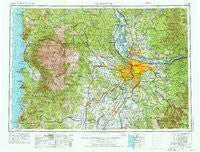
~ Vancouver WA topo map, 1:250000 scale, 1 X 2 Degree, Historical, 1958, updated 1976
Vancouver, Washington, USGS topographic map dated 1958.
Includes geographic coordinates (latitude and longitude). This topographic map is suitable for hiking, camping, and exploring, or framing it as a wall map.
Printed on-demand using high resolution imagery, on heavy weight and acid free paper, or alternatively on a variety of synthetic materials.
Topos available on paper, Waterproof, Poly, or Tyvek. Usually shipping rolled, unless combined with other folded maps in one order.
- Product Number: USGS-5689722
- Free digital map download (high-resolution, GeoPDF): Vancouver, Washington (file size: 27 MB)
- Map Size: please refer to the dimensions of the GeoPDF map above
- Weight (paper map): ca. 55 grams
- Map Type: POD USGS Topographic Map
- Map Series: HTMC
- Map Verison: Historical
- Cell ID: 396049
- Scan ID: 244451
- Imprint Year: 1976
- Woodland Tint: Yes
- Visual Version Number: 2
- Aerial Photo Year: 1973
- Edit Year: 1974
- Field Check Year: 1958
- Datum: Unstated
- Map Projection: Transverse Mercator
- Map published by: Military, Other
- Map Language: English
- Scanner Resolution: 600 dpi
- Map Cell Name: Vancouver
- Grid size: 1 X 2 Degree
- Date on map: 1958
- Map Scale: 1:250000
- Geographical region: Washington, United States
Neighboring Maps:
All neighboring USGS topo maps are available for sale online at a variety of scales.
Spatial coverage:
Topo map Vancouver, Washington, covers the geographical area associated the following places:
- Sunnyside - Sunnycrest - Oregon City - Helvetia - Charter Oak - Oceanside - Colton - Fisher - Whitford - Sherwood - Dayton - Sunnyside - Burlington - Fern Prairie - Dollar Corner - Clackamas Heights - Sunset - Dixie (historical) - Rockaway Beach - Molfait Tracts - Raleigh Hills - Cherryville - Yankton - Laurel - Felida - Twin Rocks - Boyer - Gales Creek - Midway - Brooklyn - McLoughlin Heights - Rosewood - Three Rocks - Gaston - Sheridan - Stafford - Mill Plain - Chemawa - Lafayette - Nedonna Beach - Burton - Cove Orchard - Donald - Unionvale - Brush Prairie - Valley Junction - Cedardale - Union - Irvington - Witch Hazel - Chehalem - Ridgefield - Vinemaple - Vancouver - Eagle Creek - West Haven - Riverdale - Carnation - Ballston - Burlingame - Dayton - Fishers Corner - University Park - Woodland Park - Wheeler - Newberg - Damascus - McLoughlin - Woodstock - Lakebrook - Six Corners - Firwood - Bertha (historical) - Harmony Point - George - Sylvan - Eastmoreland - Deep Creek (historical) - Fargher Lake - Hathaway Mead - Nenamusa (historical) - Eola Crest - Elliott Prairie - Liberal - Tualatin - Shady Dell - South Lake Oswego - Norwood - Timber - Yale - Elmonica - Amboy - Cruzatt - Livingston - Kinton - Midway - Hockinson - North Highland - Barlow - Parkersville
- Map Area ID: AREA4645-124.0833333-122
- Northwest corner Lat/Long code: USGSNW46-124.0833333
- Northeast corner Lat/Long code: USGSNE46-122
- Southwest corner Lat/Long code: USGSSW45-124.0833333
- Southeast corner Lat/Long code: USGSSE45-122
- Northern map edge Latitude: 46
- Southern map edge Latitude: 45
- Western map edge Longitude: -124.0833333
- Eastern map edge Longitude: -122