
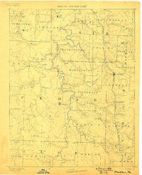
~ Stockton MO topo map, 1:125000 scale, 30 X 30 Minute, Historical, 1886, updated 1898
Stockton, Missouri, USGS topographic map dated 1886.
Includes geographic coordinates (latitude and longitude). This topographic map is suitable for hiking, camping, and exploring, or framing it as a wall map.
Printed on-demand using high resolution imagery, on heavy weight and acid free paper, or alternatively on a variety of synthetic materials.
Topos available on paper, Waterproof, Poly, or Tyvek. Usually shipping rolled, unless combined with other folded maps in one order.
- Product Number: USGS-8618734
- Free digital map download (high-resolution, GeoPDF): Stockton, Missouri (file size: 5 MB)
- Map Size: please refer to the dimensions of the GeoPDF map above
- Weight (paper map): ca. 55 grams
- Map Type: POD USGS Topographic Map
- Map Series: HTMC
- Map Verison: Historical
- Cell ID: 320669
- Scan ID: 325562
- Imprint Year: 1898
- Survey Year: 1884
- Datum: Unstated
- Map Projection: Unstated
- Map published by United States Geological Survey
- Map Language: English
- Scanner Resolution: 600 dpi
- Map Cell Name: Stockton
- Grid size: 30 X 30 Minute
- Date on map: 1886
- Map Scale: 1:125000
- Geographical region: Missouri, United States
Neighboring Maps:
All neighboring USGS topo maps are available for sale online at a variety of scales.
Spatial coverage:
Topo map Stockton, Missouri, covers the geographical area associated the following places:
- Topper - Hamlet - Hardyville - Neola - Needmore - New Oyer - Flemington - Cane Hill - Carns Ford - Bearcreek - Weaubleau - Pape - Cedar Springs - Bona - Wagoner - Arnica - Umber View Heights - Raney - Cobb - Vista - Willowville - Umber - Stockton - Fairview (historical) - Edsall (historical) - Filley - Aldrich - Tracy - Masters - Orleans (historical) - Terry - Blackjack - Caplinger Mills - Tingley - Tiffin - Rookins - Ebb (historical) - Collins - Roscoe - Fair Play - Arcola - Gerster - Crooks Springs - Ivy - Osage Heights - Cedarville - Glen Town - Claud - Humansville - Lebeck - Oyer - Hackleman Corner - Birdsong - Pacetown - Rowland - Dunnegan - Coal Hill - Crisp - Graceland - Story (historical) - Seybert
- Map Area ID: AREA3837.5-94-93.5
- Northwest corner Lat/Long code: USGSNW38-94
- Northeast corner Lat/Long code: USGSNE38-93.5
- Southwest corner Lat/Long code: USGSSW37.5-94
- Southeast corner Lat/Long code: USGSSE37.5-93.5
- Northern map edge Latitude: 38
- Southern map edge Latitude: 37.5
- Western map edge Longitude: -94
- Eastern map edge Longitude: -93.5


