
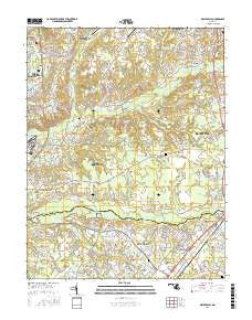
~ Piscataway MD topo map, 1:24000 scale, 7.5 X 7.5 Minute, 2016
Piscataway, Maryland, USGS topographic map dated 2016.
Includes geographic coordinates (latitude and longitude). This topographic map is suitable for hiking, camping, and exploring, or framing it as a wall map.
Printed on-demand using high resolution imagery, on heavy weight and acid free paper, or alternatively on a variety of synthetic materials.
Topos available on paper, Waterproof, Poly, or Tyvek. Usually shipping rolled, unless combined with other folded maps in one order.
- Product Number: USGS-8566484
- Free digital map download (high-resolution, GeoPDF): Piscataway, Maryland (file size: 28 MB)
- Map Size: please refer to the dimensions of the GeoPDF map above
- Weight (paper map): ca. 55 grams
- Map Type: POD USGS Topographic Map
- Map Series: US Topo
- Map Verison: Current
- Cell ID: 35439
- Datum: North American Datum of 1983
- Map Projection: Transverse Mercator
- Map Cell Name: Piscataway
- Grid size: 7.5 X 7.5 Minute
- Date on map: 2016
- Map Scale: 1:24000
- Geographical region: Maryland, United States
Neighboring Maps:
All neighboring USGS topo maps are available for sale online at a variety of scales.
Spatial coverage:
Topo map Piscataway, Maryland, covers the geographical area associated the following places:
- Springhaven - Delight - Pleasant Springs - Marbella - Tantallon South - Northwood - Rolee Estates - Clinton Hills - White Hall - White Oak Village - McDaniel Country Estates - Mattawoman - Fox Run - Belleair Estates - Weestwood Estates - Warburton Oaks - Sharperville - Piscataway Estates - Fort Washington Forest - Briarwood - Clinton Acres - Holly Hill - South Piscataway - Ashford - Parker Meadows - Bolton - White Hall Terrace - Acton Village - Constitution Hills - Brooke Jane Manor - Boniwood - Holly Tree Park - New England Estates - Idlewood Trailer Park - Green Acres - Bel Air Acres - Fort Foote Estates - Chapel Hill - Mill Hill Estates - Lancaster - White Hall Forest - Sun Valley Estates - Warburton Manor - Wellington Woods - Old Fort Acres - Gillespie Mobile Home Court - Piscataway - Cedar Lawn - Berry - Jomar Acres - Hunt Club Estates - Holly Station - Springhaven Woods - Acco Park - Greenmont - Lynnbrook - Danville - Silesia - Tippett - Treeview Estates - Friendly Farms - Idlewood Park - Accokeek Acres - Windbrook - Thrift - Blandford Village - Clinton Woods - Old Ford Hills - Lakeside Mews - Willbrook - Valley View - Piscataway Hills
- Map Area ID: AREA38.7538.625-77-76.875
- Northwest corner Lat/Long code: USGSNW38.75-77
- Northeast corner Lat/Long code: USGSNE38.75-76.875
- Southwest corner Lat/Long code: USGSSW38.625-77
- Southeast corner Lat/Long code: USGSSE38.625-76.875
- Northern map edge Latitude: 38.75
- Southern map edge Latitude: 38.625
- Western map edge Longitude: -77
- Eastern map edge Longitude: -76.875


