
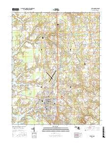
~ Easton MD topo map, 1:24000 scale, 7.5 X 7.5 Minute, 2016
Easton, Maryland, USGS topographic map dated 2016.
Includes geographic coordinates (latitude and longitude). This topographic map is suitable for hiking, camping, and exploring, or framing it as a wall map.
Printed on-demand using high resolution imagery, on heavy weight and acid free paper, or alternatively on a variety of synthetic materials.
Topos available on paper, Waterproof, Poly, or Tyvek. Usually shipping rolled, unless combined with other folded maps in one order.
- Product Number: USGS-8566472
- Free digital map download (high-resolution, GeoPDF): Easton, Maryland (file size: 25 MB)
- Map Size: please refer to the dimensions of the GeoPDF map above
- Weight (paper map): ca. 55 grams
- Map Type: POD USGS Topographic Map
- Map Series: US Topo
- Map Verison: Current
- Cell ID: 13523
- Datum: North American Datum of 1983
- Map Projection: Transverse Mercator
- Map Cell Name: Easton
- Grid size: 7.5 X 7.5 Minute
- Date on map: 2016
- Map Scale: 1:24000
- Geographical region: Maryland, United States
Neighboring Maps:
All neighboring USGS topo maps are available for sale online at a variety of scales.
Spatial coverage:
Topo map Easton, Maryland, covers the geographical area associated the following places:
- Mount Pleasant - Calvert Terrace - Poplar Hill - Ashby Park - Jensen's Hyde Park - Chapel Station - Old Villa - Fausley - Glebe Villa - Mulberry Hill - Mecklenburg - Riser Place - Carters Plains - Walkertown - Hyde Park Trailer Park - Easton - Swan Haven - Morgans Neglect - Williamsburg (historical) - North Easton - Clearview - Clifton - Glenwood Heights - South Pennsfield - Saint Aubins Heights - Pennsfield - Woodland - Longwoods - Waverly - Idlewild - Londonderry - Stoney Ridge - Chilcutt - Woodland - Bloomfield - Goldsborough (historical) - Crofton - North Glenwood - Carrolls Addition - Woodland Farms - Talbot Village - Golton - Chaple - West Galloway - North Bend Woodland - Colonial Heights - Lednums Corner - Crabapple Court - Dover Acres - Brookwood Estates - Fosters Mobile Home Park - Rice Land - Swann Haven Mobile Home Park - Third Haven Heights - Higgins - Talbot Mobile Home Park
- Map Area ID: AREA38.87538.75-76.125-76
- Northwest corner Lat/Long code: USGSNW38.875-76.125
- Northeast corner Lat/Long code: USGSNE38.875-76
- Southwest corner Lat/Long code: USGSSW38.75-76.125
- Southeast corner Lat/Long code: USGSSE38.75-76
- Northern map edge Latitude: 38.875
- Southern map edge Latitude: 38.75
- Western map edge Longitude: -76.125
- Eastern map edge Longitude: -76


