
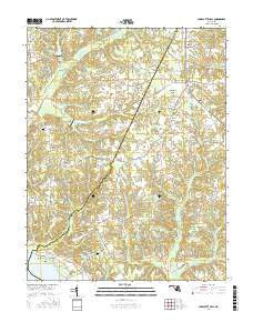
~ Charlotte Hall MD topo map, 1:24000 scale, 7.5 X 7.5 Minute, 2016
Charlotte Hall, Maryland, USGS topographic map dated 2016.
Includes geographic coordinates (latitude and longitude). This topographic map is suitable for hiking, camping, and exploring, or framing it as a wall map.
Printed on-demand using high resolution imagery, on heavy weight and acid free paper, or alternatively on a variety of synthetic materials.
Topos available on paper, Waterproof, Poly, or Tyvek. Usually shipping rolled, unless combined with other folded maps in one order.
- Product Number: USGS-8566464
- Free digital map download (high-resolution, GeoPDF): Charlotte Hall, Maryland (file size: 29 MB)
- Map Size: please refer to the dimensions of the GeoPDF map above
- Weight (paper map): ca. 55 grams
- Map Type: POD USGS Topographic Map
- Map Series: US Topo
- Map Verison: Current
- Cell ID: 8229
- Datum: North American Datum of 1983
- Map Projection: Transverse Mercator
- Map Cell Name: Charlotte Hall
- Grid size: 7.5 X 7.5 Minute
- Date on map: 2016
- Map Scale: 1:24000
- Geographical region: Maryland, United States
Neighboring Maps:
All neighboring USGS topo maps are available for sale online at a variety of scales.
Spatial coverage:
Topo map Charlotte Hall, Maryland, covers the geographical area associated the following places:
- Redgate - Beverly Estates - Melody Acres - Ryceville - Locke Hill Estates - Chickasaw Run - Willerle Manor - Budds Creek - Dubois Park - Norwood - Country Lakes - Stilltown (historical) - The Plains - Wood-N-Dale Estates - Coffee Hill - Oaks - Birch Hanger - Arborview - Newmarket - Charlotte Hall - Amberleigh Farms - Dubois - Thompson Corner - Trenton Place - Wicomico Shores - Old Sycamore Estates
- Map Area ID: AREA38.538.375-76.875-76.75
- Northwest corner Lat/Long code: USGSNW38.5-76.875
- Northeast corner Lat/Long code: USGSNE38.5-76.75
- Southwest corner Lat/Long code: USGSSW38.375-76.875
- Southeast corner Lat/Long code: USGSSE38.375-76.75
- Northern map edge Latitude: 38.5
- Southern map edge Latitude: 38.375
- Western map edge Longitude: -76.875
- Eastern map edge Longitude: -76.75


