
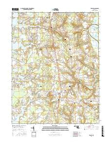
~ Trappe MD topo map, 1:24000 scale, 7.5 X 7.5 Minute, 2016
Trappe, Maryland, USGS topographic map dated 2016.
Includes geographic coordinates (latitude and longitude). This topographic map is suitable for hiking, camping, and exploring, or framing it as a wall map.
Printed on-demand using high resolution imagery, on heavy weight and acid free paper, or alternatively on a variety of synthetic materials.
Topos available on paper, Waterproof, Poly, or Tyvek. Usually shipping rolled, unless combined with other folded maps in one order.
- Product Number: USGS-8564487
- Free digital map download (high-resolution, GeoPDF): Trappe, Maryland (file size: 26 MB)
- Map Size: please refer to the dimensions of the GeoPDF map above
- Weight (paper map): ca. 55 grams
- Map Type: POD USGS Topographic Map
- Map Series: US Topo
- Map Verison: Current
- Cell ID: 45565
- Datum: North American Datum of 1983
- Map Projection: Transverse Mercator
- Map Cell Name: Trappe
- Grid size: 7.5 X 7.5 Minute
- Date on map: 2016
- Map Scale: 1:24000
- Geographical region: Maryland, United States
Neighboring Maps:
All neighboring USGS topo maps are available for sale online at a variety of scales.
Spatial coverage:
Topo map Trappe, Maryland, covers the geographical area associated the following places:
- Bristolwood - Williamsburg - Trappe - Canterbury - Frankford - Hambleton - Patrick Plains - Ivytown - Trappe Landing - Cooks Hope - Sailors Retreat - Llandaff - Barber - Gilnock Hall - Country Club Estates - Hampton - Peachblossom - Ellenborough - Cedar Point - La Trappe Heights - Waverly Island Estates - Peach Blossom Heights - Springfield - Peach Orchard - Beechwood - Manadier - Oaklands - South Beechwood - Locust Grove - Holly Oaks
- Map Area ID: AREA38.7538.625-76.125-76
- Northwest corner Lat/Long code: USGSNW38.75-76.125
- Northeast corner Lat/Long code: USGSNE38.75-76
- Southwest corner Lat/Long code: USGSSW38.625-76.125
- Southeast corner Lat/Long code: USGSSE38.625-76
- Northern map edge Latitude: 38.75
- Southern map edge Latitude: 38.625
- Western map edge Longitude: -76.125
- Eastern map edge Longitude: -76


