
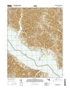
~ Broomes Island MD topo map, 1:24000 scale, 7.5 X 7.5 Minute, 2016
Broomes Island, Maryland, USGS topographic map dated 2016.
Includes geographic coordinates (latitude and longitude). This topographic map is suitable for hiking, camping, and exploring, or framing it as a wall map.
Printed on-demand using high resolution imagery, on heavy weight and acid free paper, or alternatively on a variety of synthetic materials.
Topos available on paper, Waterproof, Poly, or Tyvek. Usually shipping rolled, unless combined with other folded maps in one order.
- Product Number: USGS-8564443
- Free digital map download (high-resolution, GeoPDF): Broomes Island, Maryland (file size: 29 MB)
- Map Size: please refer to the dimensions of the GeoPDF map above
- Weight (paper map): ca. 55 grams
- Map Type: POD USGS Topographic Map
- Map Series: US Topo
- Map Verison: Current
- Cell ID: 5671
- Datum: North American Datum of 1983
- Map Projection: Transverse Mercator
- Map Cell Name: Broomes Island
- Grid size: 7.5 X 7.5 Minute
- Date on map: 2016
- Map Scale: 1:24000
- Geographical region: Maryland, United States
Neighboring Maps:
All neighboring USGS topo maps are available for sale online at a variety of scales.
Spatial coverage:
Topo map Broomes Island, Maryland, covers the geographical area associated the following places:
- Patterson Park - Bowens - Queen Tree Landing - Broomes Island - Mackall - Harbor Hills - Emerald Cove - Sotterley - Matapeake - Hollywood Shores - Wallville - Cypress Knolls - Saint Marys Beach - Western Shores - Drumcliff - Mutual Estates - Parker Wharf - Mutual Consent - Briscoe - Saint Leonard - Mutual - Williams Wharf - Battle (historical) - Nostalgia - Olde Mill - Lancaster Hill - Ross Woods - Riverwood Farms - Another Place - Honey Cove Estates - Wildwood - Fox Hill - Wells Cove - Wallville Acres - Sandgates - Kenwood Beach - Mackall Estates - Chippingwood - Hellen - Goodwins - Island Creek - Blue Dolphin Estates - Forest Glade - Home Place - Hillside Manor - Adelina - Maryland Gardens - Long Cove Estates - Halls Hacienda
- Map Area ID: AREA38.538.375-76.625-76.5
- Northwest corner Lat/Long code: USGSNW38.5-76.625
- Northeast corner Lat/Long code: USGSNE38.5-76.5
- Southwest corner Lat/Long code: USGSSW38.375-76.625
- Southeast corner Lat/Long code: USGSSE38.375-76.5
- Northern map edge Latitude: 38.5
- Southern map edge Latitude: 38.375
- Western map edge Longitude: -76.625
- Eastern map edge Longitude: -76.5


