
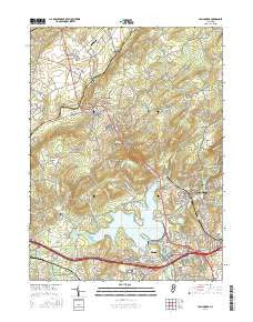
~ High Bridge NJ topo map, 1:24000 scale, 7.5 X 7.5 Minute, 2016
High Bridge, New Jersey, USGS topographic map dated 2016.
Includes geographic coordinates (latitude and longitude). This topographic map is suitable for hiking, camping, and exploring, or framing it as a wall map.
Printed on-demand using high resolution imagery, on heavy weight and acid free paper, or alternatively on a variety of synthetic materials.
Topos available on paper, Waterproof, Poly, or Tyvek. Usually shipping rolled, unless combined with other folded maps in one order.
- Product Number: USGS-8538561
- Free digital map download (high-resolution, GeoPDF): High Bridge, New Jersey (file size: 29 MB)
- Map Size: please refer to the dimensions of the GeoPDF map above
- Weight (paper map): ca. 55 grams
- Map Type: POD USGS Topographic Map
- Map Series: US Topo
- Map Verison: Current
- Cell ID: 20351
- Datum: North American Datum of 1983
- Map Projection: Transverse Mercator
- Map Cell Name: High Bridge
- Grid size: 7.5 X 7.5 Minute
- Date on map: 2016
- Map Scale: 1:24000
- Geographical region: New Jersey, United States
Neighboring Maps:
All neighboring USGS topo maps are available for sale online at a variety of scales.
Spatial coverage:
Topo map High Bridge, New Jersey, covers the geographical area associated the following places:
- Clarksville - New Hampton - Charlestown - Hensfoot - Hampton Junction - Mariannes Corner - Franklin - Clinton - Stone Mill - Changewater - Readingsburg - Red Mill - Glen Gardner - Polktown - Union - Bells Crossing - Bunnvale - Woodglen - Newport - Spruce Run - Perryville - Anthony - Norton - Annandale - High Bridge - Van Syckel - Pierce Heights - Cedar Heights - Hampton
- Map Area ID: AREA40.7540.625-75-74.875
- Northwest corner Lat/Long code: USGSNW40.75-75
- Northeast corner Lat/Long code: USGSNE40.75-74.875
- Southwest corner Lat/Long code: USGSSW40.625-75
- Southeast corner Lat/Long code: USGSSE40.625-74.875
- Northern map edge Latitude: 40.75
- Southern map edge Latitude: 40.625
- Western map edge Longitude: -75
- Eastern map edge Longitude: -74.875


