
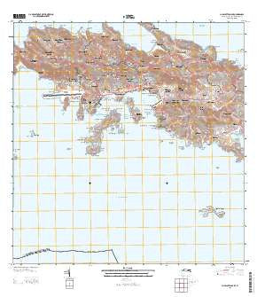
~ Charlotte Amalie VI topo map, 1:20000 scale, 7.5 X 7.5 Minute, 2013
Charlotte Amalie, Virgin Islands, USGS topographic map dated 2013.
Includes geographic coordinates (latitude and longitude). This topographic map is suitable for hiking, camping, and exploring, or framing it as a wall map.
Printed on-demand using high resolution imagery, on heavy weight and acid free paper, or alternatively on a variety of synthetic materials.
Topos available on paper, Waterproof, Poly, or Tyvek. Usually shipping rolled, unless combined with other folded maps in one order.
- Product Number: USGS-8537887
- Free digital map download (high-resolution, GeoPDF): Charlotte Amalie, Virgin Islands (file size: 34 MB)
- Map Size: please refer to the dimensions of the GeoPDF map above
- Weight (paper map): ca. 55 grams
- Map Type: POD USGS Topographic Map
- Map Series: US Topo
- Map Verison: Current
- Cell ID: 75905
- Datum: North American Datum of 1983
- Map Projection: Transverse Mercator
- Map Cell Name: Charlotte Amalie
- Grid size: 7.5 X 7.5 Minute
- Date on map: 2013
- Map Scale: 1:20000
- Geographical region: Virgin Islands, United States
Neighboring Maps:
All neighboring USGS topo maps are available for sale online at a variety of scales.
Spatial coverage:
Topo map Charlotte Amalie, Virgin Islands, covers the geographical area associated the following places:
- Bolongo - Raphune - Resolution - Estate Thomas - Misgen - Donoe - Peterborg - Rosendal - Mafolie - Frenchtown - Bonne Esperance - Barrett - Altona - Enighed - Contant - Bovoni - John Oley - Fort Christian - Neltjeberg - Canaan - Bellevue - Adelphi - Ensomned - Louisenhoj - Sorgenfri - Cowell Battery - Pearson Gardens - Mandal - Dorothea - Tutu - Charlotte Amalie - Lilliendahl - Mariendal - Lovenlund - Lerkenlund - Hoffman - Zambee - Solberg - Caret Bay Estate - Santa Maria Estate - Nadir
- Map Area ID: AREA18.37518.25-65-64.875
- Northwest corner Lat/Long code: USGSNW18.375-65
- Northeast corner Lat/Long code: USGSNE18.375-64.875
- Southwest corner Lat/Long code: USGSSW18.25-65
- Southeast corner Lat/Long code: USGSSE18.25-64.875
- Northern map edge Latitude: 18.375
- Southern map edge Latitude: 18.25
- Western map edge Longitude: -65
- Eastern map edge Longitude: -64.875


