
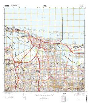
~ San Juan PR topo map, 1:20000 scale, 7.5 X 7.5 Minute, 2013
San Juan, Puerto Rico, USGS topographic map dated 2013.
Includes geographic coordinates (latitude and longitude). This topographic map is suitable for hiking, camping, and exploring, or framing it as a wall map.
Printed on-demand using high resolution imagery, on heavy weight and acid free paper, or alternatively on a variety of synthetic materials.
Topos available on paper, Waterproof, Poly, or Tyvek. Usually shipping rolled, unless combined with other folded maps in one order.
- Product Number: USGS-8537867
- Free digital map download (high-resolution, GeoPDF): San Juan, Puerto Rico (file size: 39 MB)
- Map Size: please refer to the dimensions of the GeoPDF map above
- Weight (paper map): ca. 55 grams
- Map Type: POD USGS Topographic Map
- Map Series: US Topo
- Map Verison: Current
- Cell ID: 39644
- Datum: North American Datum of 1983
- Map Projection: Transverse Mercator
- Map Cell Name: San Juan
- Grid size: 7.5 X 7.5 Minute
- Date on map: 2013
- Map Scale: 1:20000
- Geographical region: Puerto Rico, United States
Neighboring Maps:
All neighboring USGS topo maps are available for sale online at a variety of scales.
Spatial coverage:
Topo map San Juan, Puerto Rico, covers the geographical area associated the following places:
- Laguna Gardens - Santa Ana - Jardines de Valencia - Delicias - Residencial Las Margaritas - Caparra Terrace - Hill Brothers - El Paradiso - Miramar - Villa Nevares - Sabana - San Francisco - Lopez Sicardo - Residence San Juan Bautista - Rio Piedras - Residencial Matienzo Cintron - Park Gardens - Torrimar - Punta Las Marías - Cayo Hueso - Biascoechea - Parkside - Los Maestros - Villa Andalucia - Summit Hills - Parcelas Falú - El Palmar - Club Manor - Town Park - Villa Mar - Puerto Nuevo Norte - Floral Park - Ramón Nevares - Cantera - Las Lomas - Eleanor Roosevelt - Baldrich - Central Vannia (historical) - Villa Borinquen - Suchville - Amelia - Campo Rico - Monterrey - Fuerte San Gerónimo - Caparra Hills - Martín Peña - Villa Capri - Martin Martell - Guaynabo Zona Urbana - Israel - Atlantic View - Bello Horizonte - La Vista - Monteflores - Santiago Iglesias - Jardines del Paraiso - Villa Panamericana - Reparto Universitario San Antonio - Highland Park - Vosburg - University Gardens - Villa Grande - De Diego - Vietnam - Truman - Los Frailes - Villa Marina - Berwind Estates - Los Peñas - Altamesa - Parque - Iturregui - Buen Consejo - Country Club - Las Palmas - Ramos Antonini - Reparto Sevilla - Marruecos - Santa Rita - Cambridge Park - Concordia Gardens - Jardines Selles - San Juan Chateau - Residencial Luis Llorens Torres - Basilo Davila - Extension Las Casas - Hyde Park - El Vedado - Santa Teresita - Victor Braegger - Monte Park - La Riviera - Tras Talleres - Costa del Norte (historical) - San Juan - Colinas Vendes - Residencial El Mirador - El Viejo San Juan - Los Angeles - Villa Prades
- Map Area ID: AREA18.518.375-66.125-66
- Northwest corner Lat/Long code: USGSNW18.5-66.125
- Northeast corner Lat/Long code: USGSNE18.5-66
- Southwest corner Lat/Long code: USGSSW18.375-66.125
- Southeast corner Lat/Long code: USGSSE18.375-66
- Northern map edge Latitude: 18.5
- Southern map edge Latitude: 18.375
- Western map edge Longitude: -66.125
- Eastern map edge Longitude: -66


