
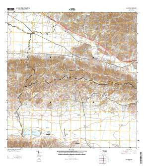
~ San German PR topo map, 1:20000 scale, 7.5 X 7.5 Minute, Current, 2013
San German, Puerto Rico, USGS topographic map dated 2013.
Includes geographic coordinates (latitude and longitude). This topographic map is suitable for hiking, camping, and exploring, or framing it as a wall map.
Printed on-demand using high resolution imagery, on heavy weight and acid free paper, or alternatively on a variety of synthetic materials.
Topos available on paper, Waterproof, Poly, or Tyvek. Usually shipping rolled, unless combined with other folded maps in one order.
- Product Number: USGS-8537865
- Free digital map download (high-resolution, GeoPDF): San German, Puerto Rico (file size: 44 MB)
- Map Size: please refer to the dimensions of the GeoPDF map above
- Weight (paper map): ca. 55 grams
- Map Type: POD USGS Topographic Map
- Map Series: US Topo
- Map Verison: Current
- Cell ID: 39622
- Datum: North American Datum of 1983
- Map Projection: Transverse Mercator
- Map Cell Name: San German
- Grid size: 7.5 X 7.5 Minute
- Date on map: 2013
- Map Scale: 1:20000
- Geographical region: Puerto Rico, United States
Neighboring Maps:
All neighboring USGS topo maps are available for sale online at a variety of scales.
Spatial coverage:
Topo map San German, Puerto Rico, covers the geographical area associated the following places:
- Palmarejo Comunidad - Guanábana - Lajas Zona Urbana - San Germán - San Germán Zona Urbana - Sector Piedras Blancas - Parada de Señal Fulminante - Maguayo Comunidad - Margarita - Sabana Eneas - Finca Juanita - Hacienda Desengaño - Extension El Valle - Parada de Señal Irizarry - Riverside - El Brujo - El Retiro - Porta Coeli - Monte Grande - Monte Grande Comunidad - Palmarejo - Santa Marta - Coto - El Recreo - Reparto El Valle - Hacienda Resolución - Filial Amor (historical) - Hacienda Beatriz Soledad - Jardines de Lajas - Hacienda Luisa - Alturas de Lajas Number 1 - Llanos - Barriada Tomei - Vivoni - El Valle - Alturas de Lajas Number 2 - Olivares - Hacienda Coto - Maguayo - Hospital Concepcion - Sabana Eneas Comunidad - Hacienda Julia - Lajas Arriba - Lajas - San Ramón
- Map Area ID: AREA18.12518-67.125-67
- Northwest corner Lat/Long code: USGSNW18.125-67.125
- Northeast corner Lat/Long code: USGSNE18.125-67
- Southwest corner Lat/Long code: USGSSW18-67.125
- Southeast corner Lat/Long code: USGSSE18-67
- Northern map edge Latitude: 18.125
- Southern map edge Latitude: 18
- Western map edge Longitude: -67.125
- Eastern map edge Longitude: -67


