
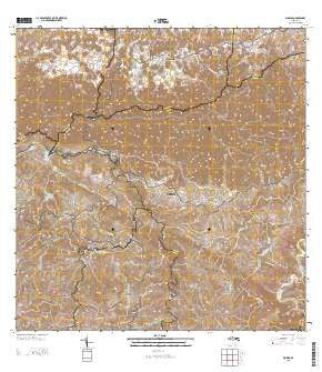
~ Florida PR topo map, 1:20000 scale, 7.5 X 7.5 Minute, 2013
Florida, Puerto Rico, USGS topographic map dated 2013.
Includes geographic coordinates (latitude and longitude). This topographic map is suitable for hiking, camping, and exploring, or framing it as a wall map.
Printed on-demand using high resolution imagery, on heavy weight and acid free paper, or alternatively on a variety of synthetic materials.
Topos available on paper, Waterproof, Poly, or Tyvek. Usually shipping rolled, unless combined with other folded maps in one order.
- Product Number: USGS-8537775
- Free digital map download (high-resolution, GeoPDF): Florida, Puerto Rico (file size: 53 MB)
- Map Size: please refer to the dimensions of the GeoPDF map above
- Weight (paper map): ca. 55 grams
- Map Type: POD USGS Topographic Map
- Map Series: US Topo
- Map Verison: Current
- Cell ID: 15631
- Datum: North American Datum of 1983
- Map Projection: Transverse Mercator
- Map Cell Name: Florida
- Grid size: 7.5 X 7.5 Minute
- Date on map: 2013
- Map Scale: 1:20000
- Geographical region: Puerto Rico, United States
Neighboring Maps:
All neighboring USGS topo maps are available for sale online at a variety of scales.
Spatial coverage:
Topo map Florida, Puerto Rico, covers the geographical area associated the following places:
- Montebello - Villas de Florida - Segui - Montaña - Hacienda Marqués - Hacienda Reynés - Hacienda Vega Grande - Sector Los Quemaos - Hacienda Butler - Hacienda Aldea - Estancias de Florida - Sector Las Parcelas - Hacienda Colom - Hacienda Garau - Hacienda La Isolina - Hacienda Piedra Gorda - Camarones - Alturas de Yanes Segunda Seccion - Hacienda Santa Bárbara - Hacienda Tetuán - Hacienda Peñonales - Hacienda San José - Rafael Arroyo - Selgas - Sector La Ceiba - La Fuente - Florida - Hacienda Flor de Alba - Hacienda Santa Elena - Hacienda La Catalana - Alturas de Florida - Florida Zona Urbana - Florida - Hacienda Las Abras - Negrito - Alturas de Yanes Primera Seccion - Hacienda Limón
- Map Area ID: AREA18.37518.25-66.625-66.5
- Northwest corner Lat/Long code: USGSNW18.375-66.625
- Northeast corner Lat/Long code: USGSNE18.375-66.5
- Southwest corner Lat/Long code: USGSSW18.25-66.625
- Southeast corner Lat/Long code: USGSSE18.25-66.5
- Northern map edge Latitude: 18.375
- Southern map edge Latitude: 18.25
- Western map edge Longitude: -66.625
- Eastern map edge Longitude: -66.5


