
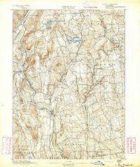
~ New Milford CT topo map, 1:62500 scale, 15 X 15 Minute, Historical, 1892
New Milford, Connecticut, USGS topographic map dated 1892.
Includes geographic coordinates (latitude and longitude). This topographic map is suitable for hiking, camping, and exploring, or framing it as a wall map.
Printed on-demand using high resolution imagery, on heavy weight and acid free paper, or alternatively on a variety of synthetic materials.
Topos available on paper, Waterproof, Poly, or Tyvek. Usually shipping rolled, unless combined with other folded maps in one order.
- Product Number: USGS-8506924
- Free digital map download (high-resolution, GeoPDF): New Milford, Connecticut (file size: 10 MB)
- Map Size: please refer to the dimensions of the GeoPDF map above
- Weight (paper map): ca. 55 grams
- Map Type: POD USGS Topographic Map
- Map Series: HTMC
- Map Verison: Historical
- Cell ID: 58379
- Scan ID: 331112
- Survey Year: 1889
- Datum: Unstated
- Map Projection: Unstated
- Map published by United States Geological Survey
- Map Language: English
- Scanner Resolution: 600 dpi
- Map Cell Name: New Milford
- Grid size: 15 X 15 Minute
- Date on map: 1892
- Map Scale: 1:62500
- Geographical region: Connecticut, United States
Neighboring Maps:
All neighboring USGS topo maps are available for sale online at a variety of scales.
Spatial coverage:
Topo map New Milford, Connecticut, covers the geographical area associated the following places:
- Lower Merryall - Warren - New Milford - Woodville - Bridgewater - East Kent - Birch Groves - Upper Merryall - Joyceland (historical) - Gaylordsville - Lakeside Woods - New Preston - Marble Dale - Hurds Corner - Candlewood Springs - Merwinsville - Erickson Corner - Emmons City (historical) - Roxbury Falls - Wellsville - Washington - Chimney Point - South Kent - Kent - Sherman - Candlewood Point - Horse Heaven - Northville - West Morris - Kent Furnace - Roxbury Station - Macedonia - Flanders - Romford - Roxbury - Atchison Cove - Park Lane - Lanesville - Hickory Haven
- Map Area ID: AREA41.7541.5-73.5-73.25
- Northwest corner Lat/Long code: USGSNW41.75-73.5
- Northeast corner Lat/Long code: USGSNE41.75-73.25
- Southwest corner Lat/Long code: USGSSW41.5-73.5
- Southeast corner Lat/Long code: USGSSE41.5-73.25
- Northern map edge Latitude: 41.75
- Southern map edge Latitude: 41.5
- Western map edge Longitude: -73.5
- Eastern map edge Longitude: -73.25


