
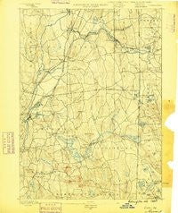
~ Moosup CT topo map, 1:62500 scale, 15 X 15 Minute, Historical, 1889
Moosup, Connecticut, USGS topographic map dated 1889.
Includes geographic coordinates (latitude and longitude). This topographic map is suitable for hiking, camping, and exploring, or framing it as a wall map.
Printed on-demand using high resolution imagery, on heavy weight and acid free paper, or alternatively on a variety of synthetic materials.
Topos available on paper, Waterproof, Poly, or Tyvek. Usually shipping rolled, unless combined with other folded maps in one order.
- Product Number: USGS-8506870
- Free digital map download (high-resolution, GeoPDF): Moosup, Connecticut (file size: 7 MB)
- Map Size: please refer to the dimensions of the GeoPDF map above
- Weight (paper map): ca. 55 grams
- Map Type: POD USGS Topographic Map
- Map Series: HTMC
- Map Verison: Historical
- Cell ID: 57866
- Scan ID: 331078
- Survey Year: 1888
- Datum: Unstated
- Map Projection: Unstated
- Map published by United States Geological Survey
- Map Language: English
- Scanner Resolution: 600 dpi
- Map Cell Name: Moosup
- Grid size: 15 X 15 Minute
- Date on map: 1889
- Map Scale: 1:62500
- Geographical region: Connecticut, United States
Neighboring Maps:
All neighboring USGS topo maps are available for sale online at a variety of scales.
Spatial coverage:
Topo map Moosup, Connecticut, covers the geographical area associated the following places:
- Glasgo - Pachaug - Oneco - Canterbury - Sterling - Bethel - Doaneville - Almyville - Wauregan - Rockville - Jewett City - Clayville - Fairbanks Corner - Hopeville - Moosup Valley - Wauregan Station - Escoheag - Voluntown - Moosup - Plainfield - West Wauregan - Preston City - Rice City - Packer - Beachdale - Ekonk - Central Village - Hopkins Hollow - Dorrville (historical) - Vaughn Hollow
- Map Area ID: AREA41.7541.5-72-71.75
- Northwest corner Lat/Long code: USGSNW41.75-72
- Northeast corner Lat/Long code: USGSNE41.75-71.75
- Southwest corner Lat/Long code: USGSSW41.5-72
- Southeast corner Lat/Long code: USGSSE41.5-71.75
- Northern map edge Latitude: 41.75
- Southern map edge Latitude: 41.5
- Western map edge Longitude: -72
- Eastern map edge Longitude: -71.75


